National Register of Historic Places listings in Lincoln County, South Dakota
This is a list of the National Register of Historic Places listings in Lincoln County, South Dakota.
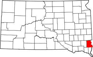
Location of Lincoln County in South Dakota
This is intended to be a complete list of the properties and districts on the National Register of Historic Places in Lincoln County, South Dakota, United States. The locations of National Register properties and districts for which the latitude and longitude coordinates are included below, may be seen in a map.[1]
There are 27 properties and districts listed on the National Register in the county, including 1 National Historic Landmark. Another 2 properties were once listed but have been removed.
- This National Park Service list is complete through NPS recent listings posted August 14, 2020.[2]
Current listings
| [3] | Name on the Register[4] | Image | Date listed[5] | Location | City or town | Description |
|---|---|---|---|---|---|---|
| 1 | Dr. Andrew Anderson House | 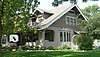 Dr. Andrew Anderson House |
February 5, 2003 (#02001765) |
416 E. 2nd St. 43°18′14″N 96°35′18″W |
Canton | |
| 2 | Magnus O. Bergstrom House |  Magnus O. Bergstrom House |
March 17, 1994 (#94000196) |
415 S. Cedar 43°17′43″N 96°36′08″W |
Canton | |
| 3 | Blood Run Site | 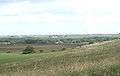 Blood Run Site |
August 29, 1970 (#70000246) |
On the Iowa/South Dakota border along the Big Sioux River[6] 43°30′01″N 96°35′49″W |
Canton, South Dakota | Extends into Lyon County, Iowa |
| 4 | Brooklyn School District No. 42 | 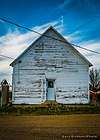 Brooklyn School District No. 42 |
December 15, 2004 (#04001364) |
29534 468th Ave. 43°06′34″N 96°50′41″W |
Beresford | |
| 5 | Byrnes House | 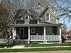 Byrnes House |
November 18, 2009 (#09000946) |
525 N. Broadway St. 43°18′17″N 96°35′29″W |
Canton | |
| 6 | Canton Asylum for American Indians Cemetery | February 20, 1998 (#98000074) |
North of the junction of U.S. Route 18 and the former Chicago, Milwaukee, St. Paul and Pacific railroad tracks 43°18′20″N 96°33′04″W |
Canton | At least 121 burials at this cemetery are dated from the existence of the Asylum, which was open from 1898 to 1934. | |
| 7 | Canton Carnegie Library | December 6, 2016 (#16000826) |
225 E. 4th St. 43°18′06″N 96°35′28″W |
Canton | ||
| 8 | Canton Lutheran Church | 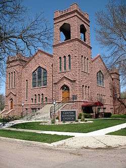 Canton Lutheran Church |
May 30, 2002 (#02000582) |
124 E. 2nd St. 43°18′14″N 96°35′30″W |
Canton | |
| 9 | Anthon W. Elster House | 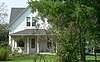 Anthon W. Elster House |
June 28, 2010 (#10000412) |
27765 476th Ave. 43°21′52″N 96°41′18″W |
Canton | |
| 10 | Dickens Round Barn | March 11, 2019 (#100003439) |
27882 473rd Ave. 43°20′50″N 96°44′24″W |
Worthing vicinity | ||
| 11 | Gale Buildings | June 27, 2019 (#100004126) |
101 and 103-107 S. Main 43°18′03″N 96°35′34″W |
Canton | ||
| 12 | Grand Valley Schoolhouse, District No. 12 | 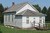 Grand Valley Schoolhouse, District No. 12 |
March 3, 1997 (#97000143) |
47872 285th St.[7] 43°15′28″N 96°38′16″W |
Canton | |
| 13 | Hansen-Hagedorn Barn |  Hansen-Hagedorn Barn |
December 11, 2013 (#13000916) |
46954 272nd St. 43°26′50″N 96°48′57″W |
Tea | |
| 14 | Harney Hospital |  Harney Hospital |
August 1, 1984 (#84003341) |
305 S. Main St. 43°21′11″N 96°53′31″W |
Lennox | |
| 15 | Hudson Boy Scout Cabin | 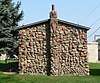 Hudson Boy Scout Cabin |
June 18, 2009 (#09000448) |
416 Wheelock St. 43°07′48″N 96°27′17″W |
Hudson | |
| 16 | John Isakson House | 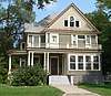 John Isakson House |
August 1, 1984 (#84003342) |
504 E. 3rd St. 43°18′11″N 96°35′14″W |
Canton | |
| 17 | C. B. Kennedy Mansion |  C. B. Kennedy Mansion |
February 9, 2001 (#01000093) |
903 N. Dakota St. 43°18′30″N 96°35′22″W |
Canton | |
| 18 | Norway Center Store | Norway Center Store |
May 30, 2003 (#03000496) |
29339 Highway 11 43°07′39″N 96°37′44″W |
Hudson | Private residence, as of 2015[8] |
| 19 | Old Main, Augustana Academy | 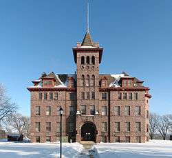 Old Main, Augustana Academy |
December 2, 1985 (#85003093) |
Lawler and 2nd Sts. 43°18′13″N 96°34′43″W |
Canton | |
| 20 | Penmarch Place |  Penmarch Place |
February 26, 1987 (#87000220) |
Penmarch Place, RD 1, Box 142 43°29′58″N 96°43′33″W |
Sioux Falls | |
| 21 | Rudolph-Parke House | 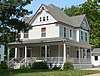 Rudolph-Parke House |
September 14, 2001 (#01001000) |
412 E. 1st St. 43°18′17″N 96°35′18″W |
Canton | |
| 22 | Mathias Schmid Farm | December 15, 2004 (#04001367) |
47405 293rd St. 43°08′35″N 96°43′32″W |
Beresford | ||
| 23 | Skartvedt House |  Skartvedt House |
February 18, 2000 (#00000121) |
224 E. 2nd St. 43°18′14″N 96°35′26″W |
Canton | |
| 24 | South Dakota Dept of Trans. Bridge No. 42-200-125 |  South Dakota Dept of Trans. Bridge No. 42-200-125 |
May 30, 2002 (#02000580) |
Three Mile Rd. 43°19′27″N 96°31′45″W |
Canton | |
| 25 | J. W. Taylor House |  J. W. Taylor House |
August 16, 2000 (#00001001) |
308 N. Broadway St. 43°18′11″N 96°35′28″W |
Canton | |
| 26 | Peder and Helga Tuntland Farmstead | March 17, 1994 (#94000194) |
Roughly 10 miles northwest of Beresford 43°09′50″N 96°39′48″W |
Beresford | ||
| 27 | Ulrickson Barn | _from_W_1.jpg) Ulrickson Barn |
August 25, 2005 (#05000946) |
Highway 11 29350 43°08′04″N 96°37′19″W |
Hudson |
Former listings
| [3] | Name on the Register | Image | Date listed | Date removed | Location | City or town | Summary |
|---|---|---|---|---|---|---|---|
| 1 | Kruger Dam | May 1, 1979 (#79002404) | February 8, 2012 | Northeast of Canton 43°23′10″N 96°31′18″W |
Canton | ||
| 2 | South Dakota Department of Transportation Bridge No. 42-103-207 | January 14, 2000 (#99001688) | March 26, 2008 | Local road over local creek 43°06′46″N 96°43′10″W |
Beresford |
gollark: It is AGPL3, although technically AGPL3 does not specify that palaiologos won't obliterate your family and wipe your hard disks for using it.
gollark: Heavpoot, how do we enable "serious discussion" mode here?
gollark: Additionally, ABR contains code of 1092741894718294 elegance.
gollark: Well, I didn't understand how that actually worked, so I ignored it.
gollark: On the results page.
See also
| Wikimedia Commons has media related to National Register of Historic Places in Lincoln County, South Dakota. |
References
- The latitude and longitude information provided in this table was derived originally from the National Register Information System, which has been found to be fairly accurate for about 99% of listings. Some locations in this table may have been corrected to current GPS standards.
- "National Register of Historic Places: Weekly List Actions". National Park Service, United States Department of the Interior. Retrieved on August 14, 2020.
- Numbers represent an ordering by significant words. Various colorings, defined here, differentiate National Historic Landmarks and historic districts from other NRHP buildings, structures, sites or objects.
- "National Register Information System". National Register of Historic Places. National Park Service. April 24, 2008.
- The eight-digit number below each date is the number assigned to each location in the National Register Information System database, which can be viewed by clicking the number.
- Location derived from this State Historical Society of Iowa website; the NRIS lists it as "Address Restricted"
- See 2017 photo, address marker at lower right.
- Zimny, Michael. "Landmarks: Norway Township Hall". South Dakota Public Broadcasting. February 27, 2015. Retrieved September 24, 2017.
| Topics | |
|---|---|
| Lists by state |
|
| Lists by insular areas | |
| Lists by associated state | |
| Other areas | |
| Related | |
| |
Municipalities and communities of Lincoln County, South Dakota, United States | ||
|---|---|---|
| Cities | | |
| Towns | ||
| Townships |
| |
| CDP | ||
| Footnotes | ‡This populated place also has portions in an adjacent county or counties | |
This article is issued from Wikipedia. The text is licensed under Creative Commons - Attribution - Sharealike. Additional terms may apply for the media files.