Nalconagar, Angul
Nalconagar is a census town in Angul district in the Indian state of Odisha. Nalconagar, Angul is a suburb of Angul, Odisha.
Nalconagar | |
|---|---|
city | |
Nalconagar Lord Jagannath Temple | |
 Nalconagar Location in Odisha, India  Nalconagar Nalconagar (India) | |
| Coordinates: 20.849°N 85.154°E | |
| Country | |
| State | Odisha |
| District | Angul |
| Population (2001) | |
| • Total | 18,038 |
| Languages | |
| • Official | Odia |
| Time zone | UTC+5:30 (IST) |
| PIN | 759145 |
| Vehicle registration | OD 19 |
| Website | odisha |
Geography
Nalconagar is located at 20.849°N 85.154°E, and 8 km from district headquarter Angul.
Demographics
As of 2001 India census,[1] Nalconagar had a population of 18,038. Males constitute 53% of the population and females 47%. NALCO has an average literacy rate of 73%, higher than the national average of 59.5%. In NALCO, 14% of the population is under 6 years of age.

Education
Saraswati Vidya Mandir Nalco Nagar, Angul was established on 21 September 1984. This school was earlier known by the name of Chinmaya Vidyalaya. Academic process of this school managed by Sikshya Vikash Samiti, Bhubaneswar. It is recognized by the Govt. of Odisha and affiliated to Board of Secondary Education, Odisha, Cuttack and Council of Higher Secondary Education, Bhubaneswar. School offers education to students of LKG to that of +2 Arts & Science.
DPS Nalconagar established in 1984 and sponsored by National Aluminium Company affiliated to the Central Board of Secondary Education (CBSE) in New Delhi. The school lies in 30 acres (12 ha) of greenery with a multi purpose hall, auditorium, library, laboratories and play fields and boasts of being only the third satellite school to be set up under the aegis of Delhi Public School Society.
'Saint Sai Montessori Play School' is situated near Junior DPS runs inside The Club. This school has 28 years of excellence in Playgroup & Pre-nursery education. This the best caring play school with unique teaching methods. Kids enjoy coming to the place. The Play School works on the philosophy of advancing the idea of "learning with joy" with many extracurricular activities.
Transportation

Nalconagar is well connected by roads (National Highway 55 (India) passes through it) and rails. The nearest train station to Nalconagar township is Angul railway station, which is 9 km away from the township. This place is directly connected by road and the nearest cities are:
- Cuttack, 107 km
- Bhubaneswar, 133 km
- Sambalpur, 168 km
- Rourkela, 214 km
Recreation

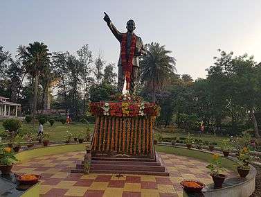
Nalconagar has a few recreation parks: Dr. B. R. Ambedkar Park, Veer Birsa Munda Park, Gopabandhu Park, Madhusudan Park. A wonderful and most entertaining Musical Fountain in nalconagar can be seen in evening at Gopabandhu Park. Musical fountain is operative from 7.30 pm to 08.00 pm in evening. All these parks are maintained by Nalconagar township welfare committee.
Other recreation center includes The Officer's Club and The club. The community center which hosts many cultural programs is one of the recreation centers,
Health
Free health services is extended to all the employees of NALCO and their dependents through a 64-bedded hospital, also an OPD center present in Nalco nagar for peripheral people.
Sports
Biju Patnaik Sports Complex is situated at the center of the township. This sports complex is about 35 acres and includes one cricket stadium, one football stadium, one hockey stadium and two volleyball court.
Design of quarters at Nalconagar

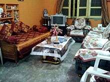
Nalconagar has quarters for NALCO's employees which is categorized into A block, B block, C block, and D block.
References
- "Census of India 2001: Data from the 2001 Census, including cities, villages and towns (Provisional)". Census Commission of India. Archived from the original on 16 June 2004. Retrieved 1 November 2008.