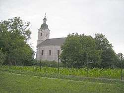
Tekovské Lužany
Tekovské Lužany (Hungarian: Nagysalló) is a village and municipality in the Levice District in the Nitra Region of Slovakia.
Tekovské Lužany | |
|---|---|
Village | |
 | |
 Tekovské Lužany Location of Tekovské Lužany in Slovakia | |
| Coordinates: 48°06′N 18°32′E | |
| Country | Slovakia |
| Region | Nitra |
| District | Levice |
| First mentioned | 1156 |
| Area | |
| • Total | 43.94 km2 (16.97 sq mi) |
| Elevation | 156 m (512 ft) |
| Population (2004-12-31) | |
| • Total | 2,937 |
| • Density | 67/km2 (170/sq mi) |
| Postal code | 935 41 |
| Area code(s) | +421-36 |
| Car plate | LV |
| Website | www.tekovskeluzany.sk |
History
In historical records the village was first mentioned in 1156. The settlement had Hungarian majority in the 17th century according to the Turkish tax census.[1]
Geography
The village lies at an altitude of 156 metres and covers an area of 43.936 km². It has a population of about 2940 people.
Facilities
The village has a public library, cinema, football pitch.
gollark: What do you mean?
gollark: The radio station is not.
gollark: Well, `bees.mp3` is... probably that?
gollark: That's `bees.mp3`.
gollark: ... the soviet national anthem?
External links
| Authority control |
|
|---|
This article is issued from Wikipedia. The text is licensed under Creative Commons - Attribution - Sharealike. Additional terms may apply for the media files.