Nagykanizsa District
Nagykanizsa (Hungarian: Nagykanizsai járás) is a district in southern part of Zala County. Nagykanizsa is also the name of the town where the district seat is found. The district is located in the Western Transdanubia Statistical Region.
Nagykanizsa District Nagykanizsai járás | |
|---|---|
 Coat of arms | |
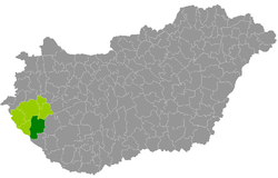 Nagykanizsa District within Hungary and Zala County. | |
| Country | |
| County | Zala |
| District seat | Nagykanizsa |
| Area | |
| • Total | 907.91 km2 (350.55 sq mi) |
| Area rank | 2nd in Zala |
| Population (2011 census) | |
| • Total | 78,252 |
| • Rank | 2nd in Zala |
| • Density | 86/km2 (220/sq mi) |
Geography
Nagykanizsa District borders with Zalaegerszeg District and Keszthely District to the north, Marcali District (Somogy County) to the east, Csurgó District (Somogy County) to the south, the Croatian county of Koprivnica-Križevci and Lenti District to the west. The number of the inhabited places in Nagykanizsa District is 49.
Municipalities
The district has 1 urban county, 1 town and 47 villages. (ordered by population, as of 1 January 2013)[1]
- Alsórajk (358)
- Balatonmagyaród (456)
- Belezna (748)
- Bocska (313)
- Börzönce (54)
- Csapi (169)
- Eszteregnye (686)
- Felsőrajk (762)
- Fityeház (649)
- Fűzvölgy (124)
- Galambok (1,244)
- Garabonc (715)
- Gelse (1,118)
- Gelsesziget (268)
- Hahót (1,066)
- Homokkomárom (193)
- Hosszúvölgy (167)
- Kacorlak (197)
- Kerecseny (237)
- Kilimán (237)
- Kisrécse (189)
- Liszó (369)
- Magyarszentmiklós (255)
- Magyarszerdahely (528)
- Miháld (786)
- Murakeresztúr (1,741)
- Nagybakónak (408)
- Nagykanizsa (49,070) – district seat
- Nagyrada (465)
- Nagyrécse (1,083)
- Nemespátró (286)
- Orosztony (422)
- Pat (226)
- Pölöskefő (390)
- Pötréte (245)
- Rigyác (391)
- Sand (404)
- Sormás (872)
- Surd (615)
- Szepetnek (1,589)
- Újudvar (960)
- Zalakaros (1,849)
- Zalakomár (2,982)
- Zalamerenye (173)
- Zalasárszeg (126)
- Zalaszabar (560)
- Zalaszentbalázs (838)
- Zalaszentjakab (321)
- Zalaújlak (118)
The bolded municipalities are cities.
gollark: Replay attacks are easy enough to deal with.
gollark: Possibly. But you run into a similar issue to the symmetric encryption thing: what if someone steals a device with access to it and/or reads the keys off?
gollark: If you trust all the devices which you'll want accessing the banking server, you could use symmetric encryption.
gollark: This has the advantage that other CC computers can't intercept it in any wya.
gollark: What I do for my ~~ultra high security~~ moderately more secure than average stuff is offload the secure parts to a webserver and require keys to access it.
See also
- List of cities and towns in Hungary
References
- "A KSH 2013. évi helységnévkönyve". ksh.hu. Retrieved 2017-10-27.
External links
| City with county rights (1) |
| |
|---|---|---|
| Town (1) | ||
| Villages (47) |
| |
This article is issued from Wikipedia. The text is licensed under Creative Commons - Attribution - Sharealike. Additional terms may apply for the media files.