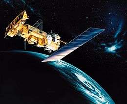
NOAA-18
NOAA-18, known before launch as NOAA-N, is a weather forecasting satellite run by NOAA. NOAA-N (18) was launched on May 20, 2005,[6] into a sun-synchronous orbit at an altitude of 854 km above the Earth, with an orbital period of 102 minutes.[7] It hosts the AMSU-A, MHS, AVHRR, Space Environment Monitor SEM/2 instrument and High Resolution Infrared Radiation Sounder (HIRS) instruments, as well as the SBUV/2 ozone-monitoring instrument.[8] It is the first NOAA POES satellite to use MHS in place of AMSU-B. NOAA-18 also hosts Cospas-Sarsat payloads.
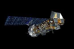 Computer-generated image of NOAA-18 in orbit | |
| Mission type | Weather satellite |
|---|---|
| Operator | NOAA |
| COSPAR ID | 2005-018A |
| SATCAT no. | 28654 |
| Mission duration | 2 years[1] |
| Spacecraft properties | |
| Spacecraft type | TIROS-N |
| Manufacturer | Lockheed Martin |
| Launch mass | 1,457 kilograms (3,212 lb)[2] |
| Power | 830 watts[3] |
| Start of mission | |
| Launch date | May 20, 2005, 10:22:01 UTC[4] |
| Rocket | Delta II 7320-10C |
| Launch site | Vandenberg SLC-2W |
| Orbital parameters | |
| Reference system | Geocentric |
| Regime | Sun-synchronous |
| Semi-major axis | 7,230.05 kilometers (4,492.54 mi)[5] |
| Eccentricity | 0.0014261[5] |
| Perigee altitude | 848 kilometers (527 mi)[5] |
| Apogee altitude | 869 kilometers (540 mi)[5] |
| Inclination | 99.17 degrees[5] |
| Period | 101.97 minutes[5] |
| Epoch | January 24, 2015, 12:53:56 UTC[5] |
Advanced TIROS-N | |
APT transmission frequency is 137.9125 MHz (NOAA-18 changed frequencies with NOAA-19 on June 23, 2009).[9]
External Links
gollark: This is slower than rust, which manages to do this extremely fast using bees.
gollark: Nim does decently well at my very unscientific web fastness benchmark™, managing 1ms average latency on a test where it generates a simple HTML page and sends it.
gollark: Yes, the """orc""" thing.
gollark: This is ridiculous and stupid, how does it detect cycles?
gollark: I mean, it compiles in reasonable time, the metaprogramming support is quite good, syntax is pleasant, libraries work...
References
- Krebs, Gunter. "NOAA 18, 19 (NOAA N, N')". Gunter's Space Page. Retrieved December 9, 2013.
- "NOAA 18". National Space Science Data Center. Retrieved December 9, 2013.
- "UCS Satellite Database". Union of Concerned Scientists. Retrieved December 8, 2013.
- McDowell, Jonathan. "Launch Log". Jonathan's Space Page. Retrieved December 9, 2013.
- "NOAA 18 Satellite details 2005-018A NORAD 28654". N2YO. January 24, 2015. Retrieved January 25, 2015.
- "NOAA-N Prime" (PDF). NP-2008-10-056-GSFC. NASA Goddard Space Flight Center. December 16, 2008. Archived from the original (PDF) on February 16, 2013. Retrieved October 8, 2010.
- "Spacecraft Status Summary". Archived from the original on November 18, 2010. Retrieved October 8, 2010.
- "NOAA-N" (PDF). Osd.noaa.gov. Archived from the original (PDF) on March 2, 2012. Retrieved March 7, 2016.
- "software to decode APT and WEFAX signals from weather satellites". WXtoImg. Retrieved March 7, 2016.
This article is issued from Wikipedia. The text is licensed under Creative Commons - Attribution - Sharealike. Additional terms may apply for the media files.