Musikot, Western Rukum
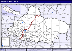
Musikot (Nepali: मुसिकोट) is a municipality and the district headquarter of Western Rukum District in Karnali province of Nepal that was established as Musikot Khalanga on 18 May 2014 by merging the two former Village development committees Musikot and Khalanga.[1][2][3] It lies on the bank of Sani Bheri River. It borders with Eastern Rukum in the east, Sanibheri rural municipality in the west, Banfikot rural municipality in the north and Tribeni rural municipality and Rolpa district in the south.[4] Musikot was formerly called Musikot Khalanga and served as the district headquarter of Rukum District.
Musikot मुसिकोट | |
|---|---|
Municipality नगरपालिका | |
 | |
 Musikot Location in Nepal | |
| Coordinates: 28.63°N 82.49°E | |
| Country | |
| Province | Karnali |
| District | Western Rukum |
| Government | |
| • Mayor | Devilal Gautam (NCP) |
| • Deputy Mayor | Prem Kumari Sunar (NCP) |
| Area | |
| • Total | 136.06 km2 (52.53 sq mi) |
| Population (2011) | |
| • Total | 32,939 |
| • Density | 240/km2 (630/sq mi) |
| Time zone | UTC+5:45 (Nepal Time) |
| Website | http://musikotmunrukum.gov.np/ |
Media
To Promote local culture Musikot has one FM radio station, Radio Sani Bheri F.M. - 89.2 MHz,[5] which is a Community radio Station.
Transportation
Rukum Salle Airport lies in Old-Musikot offering flights to Nepalgunj and Kathmandu.[6] Rapti Highway links Musikot to the Terai region of Nepal.
References
- "Musikot Municipality". Government of Nepal. Retrieved 1 May 2018.
- "72 New Municipalities Announced", Republica, 8 May 2014.
- "Govt Announces 72 New Municipalities Archived 2014-10-06 at the Wayback Machine, The Kathmandu Post, 8 May 2014.
- "National Population and Housing Census 2011" (PDF). Central Bureau of Statistics. November 2017. Archived from the original (PDF) on 27 January 2018. Retrieved 1 May 2018.
- "Radio Sani Bheri F.M 89.2 MHz". ACORAB.
- "Rukum Salle Airport" (PDF). Civil Aviation authority of Nepal. Archived from the original (PDF) on 15 May 2018. Retrieved 1 May 2018.