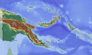
Dei Rural LLG
Dei Rural LLG is a local-level government (LLG) of Western Highlands Province, Papua New Guinea.[1][2]
Dei Rural LLG | |
|---|---|
 Dei Rural LLG Location within Papua New Guinea | |
| Coordinates: 5.755364°S 144.273404°E | |
| Country | Papua New Guinea |
| Province | Western Highlands Province |
| Time zone | UTC+10 (AEST) |
Wards
- 01. Muglamp.1
- 02. Muglamp.2
- 03. Mun
- 04. Gumanch.1
- 05. Gumanch.2
- 06. Kuk 1
- 07. Mopi
- 08. Keta
- 09. Keraldong
- 10. Kumbunga
- 11. Moga
- 12. Pung
- 13. Rauna
- 14. Kamund
- 15. Kenembomuka
- 18. Kenabuga.1
- 19. Bitam
- 29. Kindal
- 30. Palgi
- 31. Komapana
- 36. Kelem.1
- 39. Tigi.2
- 40. Kenabuga.2
- 42. Klenembo
- 47. Tigi.1
gollark: Again, the relevant maths is quite easy.
gollark: The drones don't have the ability to attain useful data.
gollark: The *maths* is easy.
gollark: The limits on this are drone sensors, not maths.
gollark: It could try going up if it hits an obstruction, or you could just make it stay a large amount above the waypoints and factor this in when creating the path tables.
References
- "Census Figures by Wards - Highlands Region". www.nso.gov.pg. 2011 National Population and Housing Census: Ward Population Profile. Port Moresby: National Statistical Office, Papua New Guinea. 2014.
- "Final Figures". www.nso.gov.pg. 2011 National Population and Housing Census: Ward Population Profile. Port Moresby: National Statistical Office, Papua New Guinea. 2014.
- OCHA FISS (2018). "Papua New Guinea administrative level 0, 1, 2, and 3 population statistics and gazetteer". Humanitarian Data Exchange. 1.31.9.
- United Nations in Papua New Guinea (2018). "Papua New Guinea Village Coordinates Lookup". Humanitarian Data Exchange. 1.31.9.
This article is issued from Wikipedia. The text is licensed under Creative Commons - Attribution - Sharealike. Additional terms may apply for the media files.