Mueang Nakhon Sawan District
Mueang Nakhon Sawan (Thai: เมืองนครสวรรค์, pronounced [mɯ̄a̯ŋ ná(ʔ).kʰɔ̄ːn sā.wǎn]) is the capital district (amphoe mueang) of Nakhon Sawan Province, in central Thailand.
Mueang Nakhon Sawan เมืองนครสวรรค์ | |
|---|---|
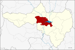 District location in Nakhon Sawan Province | |
| Coordinates: 15°42′18″N 100°8′15″E | |
| Country | Thailand |
| Province | Nakhon Sawan |
| Seat | Pak Nam Pho |
| Area | |
| • Total | 748.27 km2 (288.91 sq mi) |
| Population (2015) | |
| • Total | 243,842 |
| • Density | 330/km2 (840/sq mi) |
| Time zone | UTC+7 (ICT) |
| Postal code | 60000 |
| Geocode | 6001 |
Geography
Neighboring districts are (from the north clockwise) Banphot Phisai, Kao Liao, Chum Saeng, Tha Tako, Phayuha Khiri, Krok Phra, Lat Yao.
The main rivers of the district are the Nan and Ping, which meet in the town of Nakhon Sawan to form the Chao Phraya. In the eastern part of the district is the Bueng Boraphet swamp, the most important wetland of the province.
Administration
Central administration
Mueang Nakhon Sawan is divided into 17 subdistricts (tambons), which are further subdivided into 172 administrative villages (mubans).
| No. | Name | Thai | Villages | Pop.[1] |
|---|---|---|---|---|
| 1. | Pak Nam Pho | ปากน้ำโพ | - | 36,108 |
| 2. | Klang Daet | กลางแดด | 7 | 3,857 |
| 3. | Kriangkrai | เกรียงไกร | 12 | 5,818 |
| 4. | Khwae Yai | แควใหญ่ | 5 | 2,445 |
| 5. | Takhian Luean | ตะเคียนเลื่อน | 12 | 6,155 |
| 6. | Nakhon Sawan Tok | นครสวรรค์ตก | 10 | 48,792 |
| 7. | Nakhon Sawan Ok | นครสวรรค์ออก | 7 | 17,742 |
| 8. | Bang Phra Luang | บางพระหลวง | 6 | 2,315 |
| 9. | Bang Muang | บางม่วง | 12 | 7,746 |
| 10. | Ban Makluea | บ้านมะเกลือ | 12 | 9,762 |
| 11. | Ban Kaeng | บ้านแก่ง | 12 | 7,854 |
| 12. | Phra Non | พระนอน | 15 | 8,739 |
| 13. | Wat Sai | วัดไทรย์ | 15 | 29,675 |
| 14. | Nong Krot | หนองกรด | 17 | 19,231 |
| 15. | Nong Kradon | หนองกระโดน | 16 | 14,953 |
| 16. | Nong Pling | หนองปลิง | 8 | 17,532 |
| 17. | Bueng Senat | บึงเสนาท | 6 | 5,118 |
Local administration
There is one city (Thesaban Nakhon) in the district:
- Nakhon Sawan (Thai: เทศบาลนครนครสวรรค์) consisting of subdistrict Pak Nam Pho and parts of subdistricts Khwae Yai, Nakhon Sawan Tok, Nakhon Sawan Ok, and Wat Sai.
There is one subdistrict municipality (thesaban tambon) in the district:
- Nong Ben (Thai: เทศบาลตำบลหนองเบน) consisting of parts of subdistricts Nong Krot and Nong Kradon.
There are 16 subdistrict administrative organizations (SAO) in the district:
- Klang Daet (Thai: องค์การบริหารส่วนตำบลกลางแดด) consisting of subdistrict Klang Daet.
- Kriangkrai (Thai: องค์การบริหารส่วนตำบลเกรียงไกร) consisting of subdistrict Kriangkrai.
- Khwae Yai (Thai: องค์การบริหารส่วนตำบลแควใหญ่) consisting of parts of subdistrict Khwae Yai.
- Takhian Luean (Thai: องค์การบริหารส่วนตำบลตะเคียนเลื่อน) consisting of subdistrict Takhian Luean.
- Nakhon Sawan Tok (Thai: องค์การบริหารส่วนตำบลนครสวรรค์ตก) consisting of parts of subdistrict Nakhon Sawan Tok.
- Nakhon Sawan Ok (Thai: องค์การบริหารส่วนตำบลนครสวรรค์ออก) consisting of parts of subdistrict Nakhon Sawan Ok.
- Bang Phra Luang (Thai: องค์การบริหารส่วนตำบลบางพระหลวง) consisting of subdistrict Bang Phra Luang.
- Bang Muang (Thai: องค์การบริหารส่วนตำบลบางม่วง) consisting of subdistrict Bang Muang.
- Ban Makluea (Thai: องค์การบริหารส่วนตำบลบ้านมะเกลือ) consisting of subdistrict Ban Makluea.
- Ban Kaeng (Thai: องค์การบริหารส่วนตำบลบ้านแก่ง) consisting of subdistrict Ban Kaeng.
- Phra Non (Thai: องค์การบริหารส่วนตำบลพระนอน) consisting of subdistrict Phra Non.
- Wat Sai (Thai: องค์การบริหารส่วนตำบลวัดไทรย์) consisting of parts of subdistrict Wat Sai.
- Nong Krot (Thai: องค์การบริหารส่วนตำบลหนองกรด) consisting of parts of subdistrict Nong Krot.
- Nong Kradon (Thai: องค์การบริหารส่วนตำบลหนองกระโดน) consisting of parts of subdistrict Nong Kradon.
- Nong Pling (Thai: องค์การบริหารส่วนตำบลหนองปลิง) consisting of subdistrict Nong Pling.
- Bueng Senat (Thai: องค์การบริหารส่วนตำบลบึงเสนาท) consisting of subdistrict Bueng Senat.
References
- "Population statistics 2015" (in Thai). Department of Provincial Administration. Retrieved 2016-06-27.