Mrákotín (Chrudim District)
Mrákotín is a village in the Pardubice Region of the Czech Republic. It is located 28 kilometres (17 mi) southeast of Pardubice and 112 kilometres (70 mi) east of Prague.
Mrákotín | |
|---|---|
Village | |
 | |
_vlajka.jpg) Flag _znak.jpg) Coat of arms | |
 Mrákotín Location in the Czech Republic | |
| Coordinates: 49°48′51″N 15°57′11″E | |
| Country | Czech Republic |
| Region | Pardubice |
| District | Chrudim |
| Municipality | Mrákotín |
| First mentioned | 1456 |
| Government | |
| • Mayor | Ludmila Vacková |
| Area | |
| • Total | 5.18 km2 (2.00 sq mi) |
| Elevation | 421 m (1,381 ft) |
| Population (2014-01-01) | |
| • Total | 335 |
| • Density | 65/km2 (170/sq mi) |
| Time zone | UTC+1 (CET) |
| • Summer (DST) | UTC+2 (CEST) |
| Postal code | 539 01 |
| Website | www.obecmrakotin.cz |
The municipality covers an area of 5.15 square kilometres (1.99 sq mi) and as of 2006 it had a population of 362. First written notice about the village is from year 1456.
Village Oflenda is administrative part of Mrákotín.
Gallery
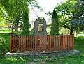 World War I memorial
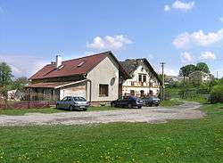
 House No 31
 Road to Mrákotín from Oldřetice
gollark: Though websites being bloated messes packed with inefficient programming, JS all the time for no reason, and ads doesn't help. My site is optimized for load speed, and I got core stuff down to about 20kB a page and do aggressive service worker caching, but most sites do *not* do this.
gollark: Web standards are insanely complex and getting more complicated by the day as they pile on more extensions for USB and Bluetooth and WebAssembly (though I like that one) and exotic CSS features.
gollark: <@343573410531639296> Don't blame browsers for the horrible mess that is web standards. With Unicode even TEXT RENDERING is a nightmare. https://gankra.github.io/blah/text-hates-you/
gollark: The best naming scheme is obviously `openssl rand -hex 16`.
gollark: https://discord.com/store/skus/707635044381884556/poland-number-1
External links
| Wikimedia Commons has media related to Mrákotín (Chrudim District). |
- Short official information about the village (in Czech)
This article is issued from Wikipedia. The text is licensed under Creative Commons - Attribution - Sharealike. Additional terms may apply for the media files.