Mpofu Nature Reserve
Mpofu Nature Reserve is a nature reserve in the Amatole district of the Eastern Cape Province, South Africa that is managed by Eastern Cape Parks.
| Mpofu Nature Reserve | |
|---|---|
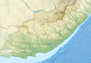
 Location within Eastern Cape | |
| Location | Eastern Cape, South Africa |
| Nearest city | Balfour |
| Coordinates | 32°37′16″S 26°35′28″E[1] |
| Area | 7,500 ha (19,000 acres) |
| Governing body | Eastern Cape Parks |
| www | |
Mpofu is situated roughly 25 km (16 miles) northwest of Fort Beaufort and 20 km (12 miles) west of Balfour. It lies on the escarpment and lower valleys of the Katberg Mountains and covers 7,500 ha (19,000 acres) with altitudes varying from 550 to 1,384 metres (1,804 to 4,541 ft). The reserve was established in 1985 from land purchased from families who were descended from the 1820 settlers.
Geography and Climate
Mpofu occupies the valleys and escarpments between the Katberg and Amatole mountain ranges. Some areas of the reserve are on steep terrain as a result. The reserve experiences its rainy season between November and March and summers are hot and humid. Autumn and winter are mainly dry and cool, and snowfalls occasionally occur on the surrounding mountain ranges. The nature reserve, like the rest of the Eastern Cape, is a malaria-free zone.[2]
Vegetation
The vegetation of the reserve comprises Grassland, Forest, and Albany Thicket biomes. Many species of flora found in these biomes are endemic to South Africa.
Wildlife
There is a large variety of mammals found in the reserve including the endangered White Rhino. Other species include Burchell's zebra, Giraffe, Bushbuck, African Buffalo, Eland, and Black-backed jackal. The bird life is also diverse, and there are many insect and reptile species found in the reserve.
 A White Rhino at the Mpofu Nature reserve
.jpg)
 Cape giraffe
.jpg)
.jpg) Cape Buffalo
Cape Buffalo_male_(32708655016).jpg)
 Black backed jackal
Activities
The reserve hosts several hiking and walking trails, including the Katberg hiking trail. There is also bird watching, educational tours and game drives available. Nearby attractions include the mountain village, Hogsback, and Khoisan rock art in Waylands. [4]
Mountain Passes
There are three passes which traverse between the Mpofu Nature reserve and the Fort Fordyce Nature Reserves:
Blinkwater Pass
The Blinkwater Pass is a 19 kilometre gravel pass which goes northward up the Amathola escarpment across the reserve. The entrance to this pass is free, however, there are gated control points. This is the longest of the three local passes that traverse the Mpofu and Fort Fordyce Nature Reserves.[5]
Fullers Hoek Pass
Fuller's Hoek Pass lies off the R67 northwest of Fort Beaufort within the Fort Fordyce Nature Reserve. It is 8 km in length and has many curves and bends. The road passes rare afromontane forest. Snow often falls in this area during the winter. [6]
Mythology
The Blinkwater Monster is said to visit the reserve regularly. The Blinkwater Monster refers to a fossil of Pareiasaurus serridens, a mammal-like reptile, which was named and discovered by Andrew Geddes Bain, a geologist and palaeontologist who discovered many fossils in the areas surrounding the reserve. He was awarded £200 by the British government in 1845 for his research.[8]
See also
- Maria Moroka Nature Reserve
- QwaQwa National Park
- South African National Parks
- Protected areas of South Africa
Notes
- "Mpofu Game Reserve Provincial Nature Reserve". protectedplanet.net. Archived from the original on 3 June 2012. Retrieved 24 September 2011.
- https://web.archive.org/web/20070708083951/http://www.ecparks.co.za/parks-reserves/mpofu/index.html Accessed 15 January 2018
- Tony Pinchuck, Barbara McCrea, Donald Reid. South Africa. Rough Guides, 2002. pg 409-410
- https://www.sa-venues.com/game-reserves/ec_mpofu.htm Accessed 15 January 2018
- https://www.mountainpassessouthafrica.co.za/find-a-pass/eastern-cape/item/989-blinkwater-pass.html Accessed 15 January 2018
- https://www.sa-venues.com/attractionsec/fullers-hoek-pass.php Accessed 15 January 2018
- https://mountainpassessouthafrica.co.za/find-a-pass/eastern-cape/item/990-bosnek-pass.html Accessed 17 January 2018
- https://www.mountainpassessouthafrica.co.za/news/item/1004-latest-news-21st-july Accessed 15 January 2018
References
- "About Mpofu Nature Reserve". Eastern Cape Parks. 1 March 2007. Archived from the original on 8 July 2007. Retrieved 19 May 2009.