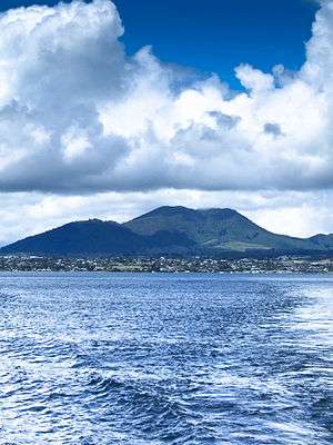
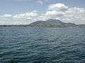
Mount Tauhara
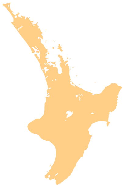
Mount Tauhara is a dormant lava dome[1] volcano in New Zealand's North Island, reaching 1,088 metres (3,570 ft) above sea level. It is situated within the Taupo caldera towards the centre of the Taupo Volcanic Zone, which stretches from White Island in the north to Mount Ruapehu in the south.[2] It is 6 kilometres (4 mi) east of the town of Taupo, next to the northeastern shore of Lake Taupo.
| Mount Tauhara | |
|---|---|
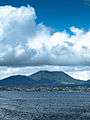
 Mount Tauhara seen from Lake Taupo | |
| Highest point | |
| Elevation | 1,088 m (3,570 ft) |
| Coordinates | 38°41′40″S 176°9′46″E |
| Geography | |
 Mount Tauhara | |
| Geology | |
| Mountain type | Lava dome |
| Volcanic arc/belt | Taupo Volcanic Zone |
| Last eruption | Around 63,000 BCE |
| Climbing | |
| Easiest route | Hike |
Formed about 65,000 years ago, Mount Tauhara was not a violently explosive vent, instead slowly oozing a viscous dacitic lava. It is the largest mass of dacite within the Taupo volcano, whose material is 98% rhyolitic.[3] Little evidence of its volcanic past remains today; the peak is covered in dense native bush.
There is a steep walking track to the top of Mount Tauhara, starting at Mountain Road. On a clear day, the summit offers excellent views over the Volcanic Plateau, encompassing the entirety of Lake Taupo in the southwest. The hike is relatively strenuous and takes about an hour and a half each way. The track is not well groomed; being slightly overgrown in some places. However, there is a pristine spring near the top perfect for drinking and the view at the summit is spectacular.
This is the Māori legend about Mt Tauhara:
- The warrior mountains of Taranaki, Pūtauaki, Tongariro and Tauhara were deeply in love with Pīhanga the mountain that stands above Turangi at the southern end of Lake Taupo. A battle erupted to win Pīhanga's favour and the victor was Tongariro. At their defeat, the other mountains decided to leave Tongariro's domain, travelling as far away as they could in the course of one night. Taranaki fled west towards the setting sun, and Pūtauaki and Tauhara fled north towards the sunrise. Pūtauaki moved fast and is now located near Whakatane and is also known as Mt Edgecumbe. But Tauhara was sad and with a heavy heart he traveled reluctantly. When overtaken by dawn he had only reached the north eastern shore of Lake Taupo. Here he stands to this day looking mournfully across the lake towards his lost love, Pīhanga.[4]
- Tauhara is the point to which Ngātoroirangi, the high priest of Te Arawa canoe, and ariki-ancestor of Tūwharetoa, climbed when he first came to the region seeking lands for his followers.[5]
"Tauhara" is Māori for "alone, or isolated".[6]
References
- https://volcano.si.edu/volcano.cfm?vn=241070&vtab=Subfeatures
- Matt McGlone. 'Ecoregions', Te Ara - the Encyclopedia of New Zealand, updated 21-Sep-2007
- Volcanic Hazards Working Group of the Civil Defence Scientific Advisory Committee, which includes scientists from the Institute of Geological and Nuclear Sciences and the Universities, Number seven "Taupo Volcanic Centre" Archived 2006-10-06 at the Wayback Machine
- Te Ahukaramū Charles Royal. 'Whenua – how the land was shaped', Te Ara - the Encyclopedia of New Zealand, updated 5-Nov-2007
- Grace, J. Te Herekiekie, (1959, reprinted 1992). "Tūwharetoa ; A history of the Māori people of the Taupo district". Reed; Auckland, Singapore.
- Reed, A.W. (1975). "Place names of New Zealand". A.H. & A.W. Reed; Wellington, Sydney, London.