Mount Spry
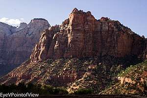
Mount Spry[2] is a small 5,720 ft mountain summit made of Navajo Sandstone in Zion National Park in Washington County of Utah, United States. Officially named in 1934, it honors William Spry (1864-1929), the third governor of Utah. The nearest higher peak is The East Temple, 0.34 miles (0.55 km) to the east.[1] Precipitation runoff from the mountain drains into tributaries of the North Fork Virgin River.
| Mount Spry | |
|---|---|
 Mount Spry | |
| Highest point | |
| Elevation | 5,720 ft (1,740 m) [1] |
| Prominence | 440 ft (130 m) [1] |
| Coordinates | 37°13′16″N 112°57′50″W [1] |
| Geography | |
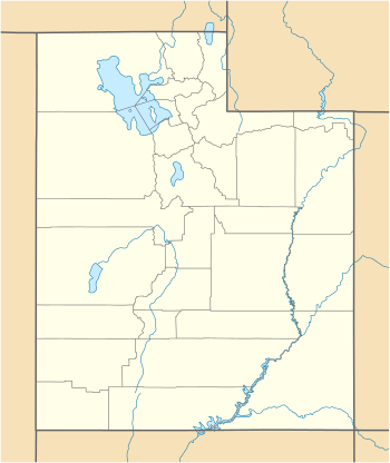 Mount Spry Location in Utah  Mount Spry Mount Spry (the United States) | |
| Location | Zion National Park Washington County, Utah United States |
| Parent range | Colorado Plateau |
| Topo map | USGS Springdale East |
| Geology | |
| Type of rock | Navajo sandstone |
| Climbing | |
| Easiest route | Scrambling class 4 |
Climbing Routes
Climbing Routes on Mount Spry[3]
- Holy Roller - class 5.10d - 5 pitches
- Swamp Donkey - class 5.12a - 5 pitches
- Shark Tooth Freighter - class 5.10 - 3 pitches
gollark: Factor has GUI capabilities also?
gollark: Brute force it.
gollark: Maybe I should upgrade our communistic/capitalistic reactors to extract power from Macron ideas.
gollark: That's not universal.
gollark: "Most" means 4% or more of the time, according to our studies.
References
- "Mount Spry, Utah". Peakbagger.com.
- U.S. Geological Survey Geographic Names Information System: Mount Spry
- Mount SpryMountain Project
External links
- Zion National Park National Park Service
Gallery
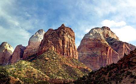
Mount Spry centered, The East Temple to right
External links
- Weather forecast: Mount Spry
This article is issued from Wikipedia. The text is licensed under Creative Commons - Attribution - Sharealike. Additional terms may apply for the media files.