Mount Hebron, Greene County, Alabama
Mount Hebron, also known as Hebron, is an unincorporated community in Greene County, Alabama, United States. Mount Hebron is located on Alabama State Route 39, 11.4 miles (18.3 km) west-northwest of Eutaw.
Mount Hebron, Alabama | |
|---|---|
 Mount Hebron  Mount Hebron | |
| Coordinates: 32°52′26″N 88°04′47″W | |
| Country | United States |
| State | Alabama |
| County | Greene |
| Elevation | 266 ft (81 m) |
| Time zone | UTC-6 (Central (CST)) |
| • Summer (DST) | UTC-5 (CDT) |
| Area code(s) | 205, 659 |
| GNIS feature ID | 156744[1] |
History
Mount Hebron was named for the mountain mentioned in the Bible.[2] A post office operated under the name Hebron from 1826 to 1833 and under the name Mount Hebron from 1837 to 1965.[3]
gollark: If I make a faster markov bot with more soul harvesting will it be installinated?
gollark: um. sure.
gollark: C is at least less bees than plain asm, thus utilize?
gollark: Utilize Rust or possibly zig but zig has issues.
gollark: apiologically bad.
References
- "Mount Hebron". Geographic Names Information System. United States Geological Survey.
- Foscue, Virginia (1989). Place Names in Alabama. Tuscaloosa: The University of Alabama Press. p. 97. ISBN 0-8173-0410-X.
- "Greene County". Jim Forte Postal History. Retrieved 10 December 2015.
Municipalities and communities of Greene County, Alabama, United States | ||
|---|---|---|
| Cities | 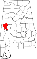 Map of Alabama highlighting Greene County | |
| Towns | ||
| Unincorporated communities | ||
This article is issued from Wikipedia. The text is licensed under Creative Commons - Attribution - Sharealike. Additional terms may apply for the media files.