Mount Afadja
Mount Afadja, known in the Ewe language as Afadjato, is the highest mountain in Ghana. The summit of this peak is located near the border with Togo, in the Volta Region of Ghana, close to the village of Liati Wote in Afadzato South District. It is about 178 kilometers (111 mi) northeast of Accra, and 178 kilometers (111 mi) northwest of Lomé. Part of the Agumatsa sub-range of the West Africa Mountains, its summit is 885 metres (2,904 ft) above sea level. The summit of Mount Aduadu (746 metres (2,448 ft)) lies 3.5 kilometers (2 mi) to the east of Mount Afadja.
| Mount Afadja | |
|---|---|
 Mount Afadja as seen from the village of Liati Wote | |
| Highest point | |
| Elevation | 885 m (2,904 ft) [1] |
| Prominence | 76 m (249 ft) [1] |
| Listing | Country high point |
| Coordinates | 7°01′37″N 0°36′12″E [1] |
| Geography | |
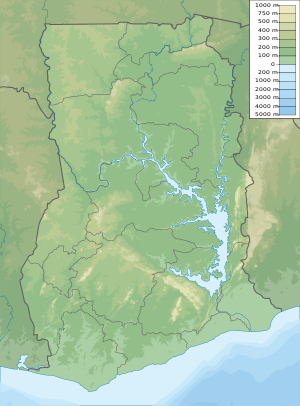
 Mount Afadja Location of Mount Afadja in Ghana | |
| Location | Hohoe Municipal District, Volta Region, Ghana |
| Parent range | Agumatsa Range |
"Afadja" is the name of the mountain whereas the suffix "-to" in the Ewe language means mountain therefore, it is called "Afadja-to" by the Ewe people of Ghana and Togo. The correct name would be "Mount Afadja", as "Mount Afadjato" would be a repetition of the word "mountain". Mount Afadja is one of the most visited tourist attractions in the Volta Region of Ghana, welcoming thousands of visitors from around the globe annually.
When the Ewe people migrated to the area and saw the mountain it looked like the mound in which water yam is planted, water yam being called "Avadze" in Ewe. Moreover, there were some creeping plants on the mountain that resembled the water yam plant; they therefore called it "Avadze-to". Today the word has been palatalized into "Afadjato".
The nearby Tagbo Falls and Wli Falls (the highest in West Africa) are also considered tourist attractions. There are several caves, streams and other waterfalls in the area. The mountains location is very close to the Ghana-Togo border.
History
Mount Afadja is the highest mountain in Ghana with the height of 885 metres and 2,904 ft above sea level. The mountain derives its name from the Ewe Word “Avadzeto” which means at war with the Bush.[2] 'Afadja' is the name of the mountain whereas 'to' in the Ewe dialect means mountain therefore it is called 'Afadjato' by the indigenes.[3] The correct name would be 'Mount Afadja' as 'Mount Afadjato' will be a repetition of the 'Mountain.'[4] The mountain is located in the Agumatsa Range near the villages of Gbledi and Liati Wote. The lush green mountains of the ridge mark the country's border with Togo.[5]
Tourist Attractions
The nearby Tagbo Falls and Wli Falls (the highest in West Africa) are also considered tourist attractions. There are several caves, streams and other waterfalls in the area.There is a plant species on the mountainsides that causes severe irritation. Shielded by the tropical forests of Ghana, the mountain provides a home to many species of flora and fauna. More than 33 species of mammals and about 300 butterfly species live in the ecological region. Also, regularly spotted in the mountains is the Mona and spotted monkeys. People often come to climb the mountain or observe the surrounding beauty. t[6]
Location
The mountain is located close to the Ghana-Togo border and Volta Lake on the east of Ghana It is. It is located in the Volta region.
References
- "Mount Afadjoto, Ghana". Peakbagger.com. 2019. Retrieved 2019-03-24.
- "Tallest Mountains In Ghana". WorldAtlas. Retrieved 2020-01-11.
- "Mount Afadja". PeakVisor. Retrieved 2020-01-11.
- "Mount Afadja". PeakVisor. Retrieved 2020-01-11.
- "Tallest Mountains In Ghana". WorldAtlas. Retrieved 2020-01-11.
- "Tallest Mountains In Ghana". WorldAtlas. Retrieved 2020-01-11.
|