Molina, Colorado
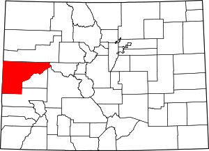
Molina is an unincorporated community and a U.S. Post Office located in Mesa County, Colorado, United States. The Molina Post Office has the ZIP Code 81646.[2]
Molina, Colorado | |
|---|---|
 Location in Mesa County and the state of Colorado  Molina, Colorado (the United States) | |
| Coordinates: 39°11′20″N 108°03′37″W | |
| Country | |
| State | |
| County | Mesa[1] |
| Elevation | 5,610 ft (1,710 m) |
| Time zone | UTC-7 (MST) |
| • Summer (DST) | UTC-6 (MDT) |
| ZIP code[2] | 81646 |
| Area code(s) | 970 |
| GNIS feature ID | 0204661 |
Geography
Molina is located at 39°11′20″N 108°03′37″W (39.188893,-108.060322).
gollark: Actually, what if we do QUOTE-terminated strings? Like in JSON.
gollark: What if we just don't terminate them?
gollark: We considered palindrome termination already.
gollark: <@231856503756161025>
gollark: I was forward thinking wrt. longer strings.
References
- "US Board on Geographic Names". United States Geological Survey. 2007-10-25. Retrieved 2008-01-31.
- "ZIP Code Lookup". United States Postal Service. January 2, 2007. Archived from the original (JavaScript/HTML) on January 1, 2008. Retrieved January 2, 2007.
This article is issued from Wikipedia. The text is licensed under Creative Commons - Attribution - Sharealike. Additional terms may apply for the media files.
