Moelfre Isaf
Moelfre Isaf is a 317 m (1,040 ft) hill located to the south of the town of Abergele. There are views towards the Clwydian Range, Snowdonia, and the Isle of Man and the Cumbrian Mountains can be seen on a clear day. Nearby is the small settlement of Moelfre, Conwy. Almost opposite is the higher hill of Moelfre Uchaf.
| Moelfre Isaf | |
|---|---|
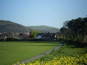 Moelfre Isaf from Pentre Mawr park, Abergele | |
| Highest point | |
| Elevation | 317 m (1,040 ft) |
| Prominence | 121 m (397 ft) |
| Listing | HuMP |
| Coordinates | 53°14′47″N 3°34′25″W |
| Geography | |
 Moelfre Isaf Conwy, Wales | |
| OS grid | SH951733 |
| Topo map | OS Landranger 116 |
This article is issued from Wikipedia. The text is licensed under Creative Commons - Attribution - Sharealike. Additional terms may apply for the media files.