Mittelberg (Thuringian Highland)
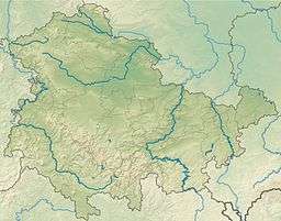
The Mittelberg is an 803.6 m high (above sea level) mountain located in the Thuringian Highland, Thuringia (Germany).
| Mittelberg | |
|---|---|
| Highest point | |
| Elevation | 803.6 m (2,636 ft) |
| Coordinates | 50°30′42″N 11°11′32″E |
| Geography | |
| Location | Thuringia, Germany |
| Parent range | Thuringian Forest |
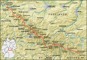
Map of the Rennsteig trail
It is located close to the municipalities of Piesau and Lichte and the Leibis-Lichte Dam in the Saalfeld-Rudolstadt district in the Thuringian Forest Nature Park.
The section of the Rennsteig walkway between Neuhaus am Rennweg, Ernstthal am Rennsteig, and Spechtsbrunn runs close to the mountain.
| Description | Height above sea level |
Direction | Particularity |
| Apelsberg | 785.3 m | W | Coniferous forest |
| Rückersbiel | 755.6 m | W NW | with the Sauhuegel (722 m, W) |
| Hahnberg | 685.3 m | NW | Pastureland |
| Mutzenberg | 770.0.6 m | N NE | Coniferous forest |
| Rauhhügel | 801.9 m | N NE | Observation tower, radio mast |
See also
- List of Mountains and Elevations of Thuringia
This article is issued from Wikipedia. The text is licensed under Creative Commons - Attribution - Sharealike. Additional terms may apply for the media files.