Missouri Route 80
Route 80 is a highway in southeastern Missouri. Its eastern terminus is at the Mississippi River in Belmont; its western terminus is at U.S. Route 61/U.S. Route 62 midway between Sikeston and New Madrid. East Prairie is the only other town on the highway.
| ||||
|---|---|---|---|---|
| Route information | ||||
| Maintained by MoDOT | ||||
| Length | 27.302 mi[1] (43.938 km) | |||
| Major junctions | ||||
| West end | ||||
| East end | Dead End at the Mississippi River in Belmont | |||
| Highway system | ||||
| ||||
At Belmont, there used to be a ferry connecting Route 80 to Kentucky Route 80, which is a major east–west thoroughfare across southern Kentucky, continuing into Virginia, as Virginia State Route 80.
Major intersections

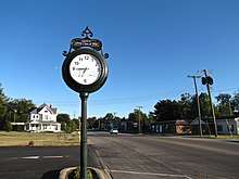
Route 80 in East Prairie
| County | Location | mi[1] | km | Destinations | Notes |
|---|---|---|---|---|---|
| New Madrid | | 0.000 | 0.000 | Western terminus; Eastern terminus of Route H | |
| | 1.505– 1.596 | 2.422– 2.569 | Diamond interchange | ||
| | 1.634 | 2.630 | Northern terminus of Route V | ||
| | 2.566 | 4.130 | Southern terminus of Route AA | ||
| New Madrid–Mississippi county line | | 8.058 | 12.968 | Southern terminus of Route B | |
| Mississippi | | 10.052 | 16.177 | Northern terminus of Route BB | |
| East Prairie | 11.171 | 17.978 | Southern terminus of Route 105 | ||
| | 13.236 | 21.301 | |||
| | 15.263 | 24.563 | Southern terminus of Route 75 | ||
| | 17.817 | 28.674 | Northern terminus of Route AA | ||
| | 21.312 | 34.298 | |||
| | 27.302 | 43.938 | Former ferry, currently a dead end[2] | ||
1.000 mi = 1.609 km; 1.000 km = 0.621 mi
| |||||
gollark: k, M, G, T, E, P, don't know.
gollark: Yes.
gollark: BRF is evil and should be discouraged.
gollark: SI prefixes.
gollark: <@148963262535434240> 1.5GRF, you mean.
References
- Missouri Department of Transportation (January 2, 2018). MoDOT HPMAPS (Map). Missouri Department of Transportation. Retrieved January 2, 2018.
- Baughn, James (August 16, 2010). "Belmont, Missouri: Where the pavement really ends". Southeast Missourian. Retrieved January 2, 2018.
This article is issued from Wikipedia. The text is licensed under Creative Commons - Attribution - Sharealike. Additional terms may apply for the media files.
