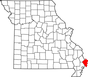
Belmont, Missouri
Belmont is an extinct town in Mississippi County, on the eastern border of the U.S. state of Missouri at the Mississippi River.[1] The GNIS classifies it as a populated place under the name "Belmont Landing".[2]
History
Belmont was platted in 1853, and named after August Belmont, a businessman interested in the site.[1] A post office called Belmont Landing was in operation from 1867 until 1869, and a post office called Belmont from 1869 until 1923.[3]
Belmont was the scene of a Civil War battle, the Battle of Belmont in 1861.[4] The community lends its name to the Columbus-Belmont State Park, a Civil War site across the Mississippi River in Hickman County, Kentucky.[5]
After the Reconstruction era, whites asserted their dominance, often by violence and intimidation. In May 1905, a mob of 200 to 300 whites lynched Tom Witherspoon, aka Robert Pettigrew, an African-American man, for alleged kidnapping and threats against a white man.[6][7] This event took place during an era of increased violence by whites against blacks due to economic problems and social tensions. A series of floods (1912, 1922, and 1937) inundated the town of Belmont, particularly the 1937 flood. Many people moved away after this destruction and the town became abandoned; the post office closed in 1923.[1]
References
- "Mississippi County Place Names, 1928–1945". The State Historical Society of Missouri. Archived from the original on June 24, 2016. Retrieved November 6, 2016.
- U.S. Geological Survey Geographic Names Information System: Belmont Landing
- "Post Offices". Jim Forte Postal History. Retrieved 6 November 2016.
- Earngey, Bill (1995). Missouri Roadsides: The Traveler's Companion. University of Missouri Press. p. 80. ISBN 978-0-8262-1021-0.
- Reigler, Susan (1 May 2011). The Complete Guide to Kentucky State Parks. University Press of Kentucky. p. 236. ISBN 0-8131-3912-0.
- Map of White Supremacy mob violence, 1835 - 1964, Monroe Work Today
- Danny Lewis, "This Map Shows Over a Century of Documented Lynchings in the United States", Smithsonian Magazine, 27 January 2017; accessed 12 April 2018
