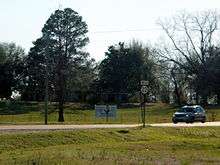
Mississippi Highway 22
Mississippi Highway 22 (MS 22) is a state highway in Mississippi, United States. It runs from east to west for approximately 43 miles (69 km), serving only two counties: Madison and Hinds.
| ||||
|---|---|---|---|---|
| Route information | ||||
| Maintained by MDOT | ||||
| Length | 42.981 mi[1] (69.171 km) | |||
| Major junctions | ||||
| West end | ||||
| East end | ||||
| Location | ||||
| Counties | Hinds, Madison | |||
| Highway system | ||||
| ||||
Locales on route
From East to West
- Canton
- Flora
- Edwards
Major intersections
| County | Location | mi | km | Destinations | Notes |
|---|---|---|---|---|---|
| Hinds | Edwards | Western terminus; northern terminus of MS 467 | |||
| | I-20 exit 19 | ||||
| Madison | Flora | ||||
| Livingston | Northern terminus of MS 463 | ||||
| Canton | Nissan Parkway | ||||
| I-55 exit 119 | |||||
| Eastern terminus | |||||
| 1.000 mi = 1.609 km; 1.000 km = 0.621 mi | |||||
gollark: https://pbs.twimg.com/media/FV74uxyXgAAS7yI?format=png
gollark: There are network effects though. People like watching popular entertainment TV so they can talk about it.
gollark: It probably depends how elastic the demand for art is.
gollark: I'm not saying everyone will stop doing art and image models will be used instead, I'm saying *commercial* art will probably switch over to image models a significant amount.
gollark: Sure. I'm questioning the commercial viability of it.
References
- "Mississippi Public Roads Selected Statistics" (PDF). Mississippi Department of Transportation. 2008. Archived from the original (PDF) on 2010-12-03. Retrieved 2010-06-03.
External links
![]()
This article is issued from Wikipedia. The text is licensed under Creative Commons - Attribution - Sharealike. Additional terms may apply for the media files.

