Mill Creek (Little River tributary)
Mill Creek is a 7.80 mi (12.55 km) long 3rd order tributary to the Little River in Moore County, North Carolina.
| Mill Creek Tributary to Little River | |
|---|---|
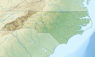
 Location of Mill Creek mouth  Mill Creek (Little River tributary) (the United States) | |
| Location | |
| Country | United States |
| State | North Carolina |
| County | Moore |
| Physical characteristics | |
| Source | Aberdeen Creek divide |
| • location | about 1.5 miles east of Pinehurst, North Carolina |
| • coordinates | 35°12′12″N 079°25′03″W[1] |
| • elevation | 470 ft (140 m)[2] |
| Mouth | Little River |
• location | about 0.25 miles east of Lakeview, North Carolina |
• coordinates | 35°14′32″N 079°17′50″W[1] |
• elevation | 246 ft (75 m)[2] |
| Length | 7.80 mi (12.55 km)[3] |
| Basin size | 20.08 square miles (52.0 km2)[4] |
| Discharge | |
| • location | Little River |
| • average | 23.90 cu ft/s (0.677 m3/s) at mouth with Little River[4] |
| Basin features | |
| Progression | northeast |
| River system | Cape Fear River |
| Tributaries | |
| • left | unnamed tributaries |
| • right | McDeeds Creek |
| Waterbodies | numerous unnamed reservoirs Crystal Lake |
| Bridges | Hunter Trail, Central Drive, Santee Road, Niagara-Carthage Road, Camp Easter Road, Aiken Road |
Course
Mill Creek rises on the Aberdeen Creek divide about 1.5 miles east of Pinehurst in Moore County, North Carolina. Mill Creek then flows northeasterly to meet the Little River about 0.25 miles east of Lakeview.[2]
Watershed
Mill Creek drains 20.08 square miles (52.0 km2) of area, receives about 49.2 in/year of precipitation, has a topographic wetness index of 448.46 and is about 34% forested.[4]
gollark: Anyway, so you can run that virtual omnidisk without actually having a disk or disk drive.
gollark: Ah yes, silly me.
gollark: Hmm, that might be a bug.
gollark: A noble goal.
gollark: But it would be hypocritical since it already uses superglobals and stuff, and everything would break.
External links
References
- "GNIS Detail - Mill Creek". geonames.usgs.gov. US Geological Survey. Retrieved 23 November 2019.
- "McDeeds Creek Topo Map, Moore County NC (Niagara Area)". TopoZone. Locality, LLC. Retrieved 23 November 2019.
- "ArcGIS Web Application". epa.maps.arcgis.com. US EPA. Retrieved 23 November 2019.
- "Mill Creek Watershed Report". Waters Geoviewer. US EPA. Retrieved 23 November 2019.
This article is issued from Wikipedia. The text is licensed under Creative Commons - Attribution - Sharealike. Additional terms may apply for the media files.