Mikušovce, Ilava District
Mikušovce (Slovak pronunciation: [ˈmikuʃɔʊ̯tsɛ]; Hungarian: Mikosfalva) is a village and municipality in Ilava District in the Trenčín Region of north-western Slovakia.
Mikušovce | |
|---|---|
Municipality | |
 | |
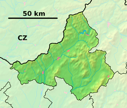 Mikušovce Location of Mikušovce in the Trenčín Region  Mikušovce Mikušovce (Slovakia) | |
| Coordinates: 49°04′00″N 18°12′20″E | |
| Country | Slovakia |
| Region | Trenčín |
| District | Ilava |
| First mentioned | 1259 |
| Area | |
| • Total | 8.496 km2 (3.280 sq mi) |
| Elevation | 360 m (1,180 ft) |
| Population | |
| • Total | 1,019 |
| • Density | 120/km2 (310/sq mi) |
| Postal code | 018 57 |
| Area code(s) | 421-42 |
| Car plate | IL |
| Website | www.mikusovce.sk |
History
In historical records the village was first mentioned in 1259.
Geography
The municipality lies at an altitude of 360 metres and covers an area of 8.496 km². It has a population of about 1019 people.
gollark: I also use it for my holoprojectors.
gollark: Relay, yep.
gollark: It was blue before today.
gollark: I accidentally rightclick my inventory system turtles with dye all the time.
gollark: Or a regular one.
External links
![]()
- Official page
- https://web.archive.org/web/20071116010355/http://www.statistics.sk/mosmis/eng/run.html
Municipalities of Ilava District | ||
|---|---|---|
This article is issued from Wikipedia. The text is licensed under Creative Commons - Attribution - Sharealike. Additional terms may apply for the media files.