Miike Domain
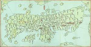
Miike Domain (三池藩, Miike-han) was a Japanese domain of the Edo period. It was associated with Chikugo Province in modern-day Fukuoka Prefecture on the island of Kyushu.
In the han system, Miike was a political and economic abstraction based on periodic cadastral surveys and projected agricultural yields.[1] In other words, the domain was defined in terms of kokudaka, not land area.[2] This was different from the feudalism of the West.
List of daimyōs
The hereditary daimyōs were head of the clan and head of the domain.
![]()
- Tanetsugu
- Tanenaga
- Taneakira
- Tsuranaga
- Nagahiro
- Tanechika
- Taneyoshi (transfer to Shimotedo Domain, succeeded by Tachibana Taneharu)
- Taneyuki (returned from Shimotedo)
gollark: Work on simpler projects until you understand lua and what docs say.
gollark: The sender ID will never match the message you want so it'll be executed once, fail, and the program will end.
gollark: It receives once. And rednet.receive returns two arguments - the sender ID AND message.
gollark: A-HA!
gollark: That too.
See also
- List of Han
- Abolition of the han system
References

- Mass, Jeffrey P. and William B. Hauser. (1987). The Bakufu in Japanese History, p. 150.
- Elison, George and Bardwell L. Smith (1987). Warlords, Artists, & Commoners: Japan in the Sixteenth Century, p. 18.
External links
- "Miike" at Edo 300 (in Japanese)
This article is issued from Wikipedia. The text is licensed under Creative Commons - Attribution - Sharealike. Additional terms may apply for the media files.