Micheweni District
Micheweni District[1] (Formerly Konde District[2]) is one of the two districts in the North Pemba Region of Tanzania. The administrative seat is the town of . As of 2002, Micheweni District had a population of 83,531.[3]
Micheweni District Konde District | |
|---|---|
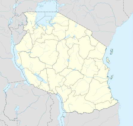
 Micheweni District Location in Tanzania | |
| Coordinates: 05°00′S 039°45′E | |
| Country | Tanzania |
| Region | North Pemba Region |
| Population (2002) | |
| • Total | 83,531 |
Administrative subdivisions
Constituencies
For parliamentary elections, Tanzania is divided into constituencies. As of the 2010 elections Micheweni District had four constituencies:[4]
- Konde Constituency
- Mgogoni Constituency
- Micheweni Constituency
- Tumbe Constituency
Divisions
Education
In the 2002 census literacy in Micheweni District stood at 40 percent for those aged 5 years and above. Literacy in Swahili was 30 percent, while 19 percent were literate in English, with 9 percent overlap.[7]
gollark: What if I store my thing's state on HDDs instead?
gollark: https://media.discordapp.net/attachments/461970193728667648/912042654752198707/unknown.png
gollark: It's not hugely popular, but tons of things still support it because momentum or something. Very useful.
gollark: Excellent.
gollark: You can just have an endpoint write stuff into an XML template of some kind, then.
References
- Micheweni (Variant) at GEOnet Names Server, United States National Geospatial-Intelligence Agency
- Konde District (Approved) at GEOnet Names Server, United States National Geospatial-Intelligence Agency
- "2002 Population and Housing General Report: North Pemba: Micheweni". Archived from the original on 18 June 2004.
- "Organisations located in Micheweni District - Tanzania". African Development Information.
- "Postcodes Kaskazini Pemba Region 75000" (PDF). 2012. Archived from the original (PDF) on 2012-09-02. Retrieved 2012-09-02.
- Micheweni (Approved) at GEOnet Names Server, United States National Geospatial-Intelligence Agency
- "2002 Population and Housing Census, Volume IV, District Profile Micheweni" (PDF). Central Census Office, National Bureau of Statistics, President's Office, Planning and Privatization, United Republic of Tanzania. 2004. Archived from the original (pdf) on 2012-09-02.
This article is issued from Wikipedia. The text is licensed under Creative Commons - Attribution - Sharealike. Additional terms may apply for the media files.