Miahuatlán de Porfirio Díaz
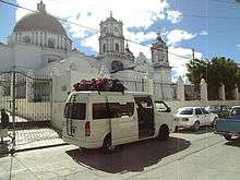
Miahuatlán de Porfirio Díaz is a town and municipality in Oaxaca in south-eastern Mexico. The municipality covers an area of 326.6 km², and is at an average elevation of 1,600 meters.

Miahuatlán de Porfirio Díaz | |
|---|---|
Municipality and town | |
 Miahuatlán de Porfirio Díaz Location in Mexico | |
| Coordinates: 16°19′N 96°35′W | |
| Country | |
| State | Oaxaca |
| Area | |
| • Total | 326.6 km2 (126.1 sq mi) |
| Population (2005) | |
| • Total | 32,185 |
| Time zone | UTC-6 (Central Standard Time) |
| • Summer (DST) | UTC-5 (Central Daylight Time) |
It is part of the Miahuatlán District in the south of the Sierra Sur Region. As of 2005, the municipality had 6,708 households with a total population of 32,185, of whom 2,517 spoke an indigenous language.[1] The name comes from the Nahuatl Miahuatlán: Miahua (ear of corn) and tlan (place or area). During the Aztec period the town was known as Miahuapan Miahuatlán, "Canal of the Corn Tassel".[2]
The city has 16 kindergartens, 12 primary schools, a technical high school and a general secondary school and a regional university, Universidad de la Sierra Sur. It has a radio station, a television station, telephone service, telegraph and a post office.[1]

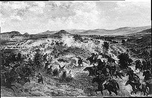
The Battle of Miahuatlán took place near the town on 3 October 1866, an important military action in which the Mexican republican troops defeated a larger force of troops of the Second Mexican Empire.[3] The battle is celebrated in an annual holiday on the date it took place.[1]
References
- "Miahuatlán de Porfirio Díaz". Enciclopedia de los Municipios de México. Instituto Nacional para el Federalismo y el Desarrollo Municipal. Archived from the original on 2011-07-18. Retrieved 2010-07-12.
- "Historia de Miahuatlán". miahuatlan-oax.com. Archived from the original on 2008-09-21. Retrieved 2010-07-12.
- David Marley (1998). Wars of the Americas: a chronology of armed conflict in the New World, 1492 to the present. ABC-CLIO. p. 561. ISBN 0-87436-837-5.