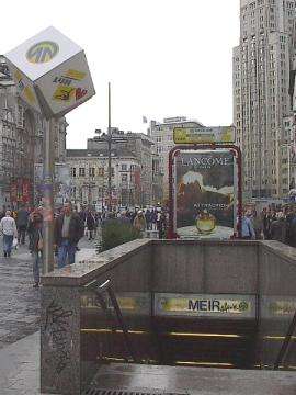
Meir premetro station
Meir is a station in the Antwerp premetro which opened on 23 March 1975. The station is located directly underneath the street Meir, after which it is named.
Meir | ||||||||||||||||||||||||||
|---|---|---|---|---|---|---|---|---|---|---|---|---|---|---|---|---|---|---|---|---|---|---|---|---|---|---|
 | ||||||||||||||||||||||||||
| Location | Belgium | |||||||||||||||||||||||||
| Coordinates | 51°13′06.114″N 04°24′20.874″E | |||||||||||||||||||||||||
| Operated by | De Lijn | |||||||||||||||||||||||||
| Construction | ||||||||||||||||||||||||||
| Structure type | underground | |||||||||||||||||||||||||
| Platform levels | 2 | |||||||||||||||||||||||||
| History | ||||||||||||||||||||||||||
| Opened | 25 March 1975 | |||||||||||||||||||||||||
| Services | ||||||||||||||||||||||||||
| ||||||||||||||||||||||||||
| Location | ||||||||||||||||||||||||||
 Meir Location within the Antwerp premetro network | ||||||||||||||||||||||||||
With Groenplaats and Opera, Meir forms the oldest part of the city's premetro network. It is served by tramlines 3, 5, 9 and 15.[1] Tram line 7 passes in close proximity at street level.[2]
Location
The station is located in central Antwerp at the western end of the Meir street. In its immediate vicinity is the Boerentoren, a 1930s art deco building which at the time of its construction was Europe's first skyscraper.[3]
gollark: ```haskellf a b c = a * b *cf = \a b c -> a * b * cf = \a -> \b -> \c -> a * b * c```
gollark: Well, `Integer -> Integer -> Integer`, in your case.
gollark: You want mult's type to be `Num a => a -> a -> a`.
gollark: ```mult :: Num a => p1 -> p2 -> p3 -> a -> a -> a -> a```
gollark: Yes, that.
References
- "Halte Antwerpen Premetrostation Meir". https://www.delijn.be/nl/haltes/halte/104720/Antwerpen_Premetrostation_Meir. Missing or empty
|url=(help)CS1 maint: location (link) - "Tramschema Antwerpen". https://static.delijn.be/Images/Flanders%20Tramschema_tcm3-5304.pdf. Missing or empty
|url=(help)CS1 maint: location (link) - "Boerentoren, Inventaris Onroerend Erfgoed [online]". Agentschap Onroerend Erfgoed. Retrieved 11 August 2016.
This article is issued from Wikipedia. The text is licensed under Creative Commons - Attribution - Sharealike. Additional terms may apply for the media files.