Meall Greigh
Meall Greigh is a mountain in the southern part of the Scottish Highlands. With Meall Garbh it forms the north-eastern end of the Ben Lawers range.
| Meall Greigh | |
|---|---|
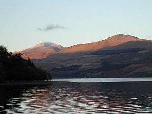 Ben Lawers (left) and Meall Greigh (right) above Loch Tay, November 2003 | |
| Highest point | |
| Elevation | 1,001 m (3,284 ft) [1] |
| Prominence | 167 m (548 ft) |
| Listing | Munro, Marilyn |
| Naming | |
| English translation | Hill of the Horse Studs |
| Language of name | Gaelic |
| Pronunciation | Scottish Gaelic: [ˈmjaul̪ˠ ˈkɾʲe] |
| Geography | |
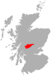
| Location | Perth and Kinross, Scotland |
| OS grid | NN674438 |
| Topo map | OS Landranger 51 |
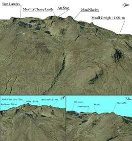
Meall Greigh 3D map
References
- "walkhighlands Meall Greigh". walkhighlands.co.uk. 2013. Retrieved 26 October 2013.
| Wikimedia Commons has media related to Meall Greigh. |

This article is issued from Wikipedia. The text is licensed under Creative Commons - Attribution - Sharealike. Additional terms may apply for the media files.