McLaurin, Mississippi
McLaurin is a small unincorporated community in Forrest County, Mississippi.[1]
McLaurin, Mississippi | |
|---|---|
 McLaurin Location within the state of Mississippi | |
| Coordinates: 31°10′05″N 89°13′2″W | |
| Country | United States |
| State | Mississippi |
| County | Forrest |
| Elevation | 354 ft (108 m) |
| Time zone | UTC-6 (Central (CST)) |
| • Summer (DST) | UTC-5 (CDT) |
| GNIS feature ID | 693929[1] |
History
The town of McLaurin is named for General McLaurin, who was also the first president of the Gulf and Ship Island Railroad.[2] At one time, McLaurin was the site of the largest sawmill in the country, becoming an important shipping site for masonite and pulp wood. The manager of the first sawmill in the area, Jim Barron, is buried in McLaurin Cemetery.
The population in 1900 was 300.[3]
A historic landing field for aircraft is located south of the settlement.[4]
Education
- Forrest County Agricultural High School
- South Forrest Elementary School
Infrastructure
Transportation
McLaurin is served by U.S. Route 49, a north-south corridor that runs through Arkansas and Mississippi.
Places of worship
- McLaurin United Methodist Church
- Morning Star Church
- Old Enon Church
- First Baptist Church of McLaurin
gollark: And allow you to lock gazillions of channels.
gollark: That would cause issues with the planned peering implementation.
gollark: <@151391317740486657> No, not adding that.
gollark: You can also do weird things like negative integer channels.
gollark: Why do you äsk?
References
- U.S. Geological Survey Geographic Names Information System: McLaurin
- Gannett, Henry (1905). The Origin of Certain Place Names in the United States. U.S. Government Printing Office. p. 194.
- Rowland, Dunbar (1907). Mississippi: Comprising Sketches of Counties, Towns, Events, Institutions, and Persons, Arranged in Cyclopedic Form. 2. Southern Historical Publishing Association. p. 188.
- U.S. Geological Survey Geographic Names Information System: McLaurin Landing Field (historical)
Municipalities and communities of Forrest County, Mississippi, United States | ||
|---|---|---|
| Cities | 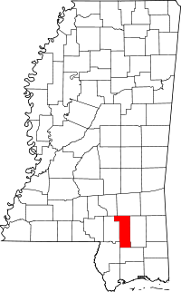 Map of Mississippi highlighting Forrest County | |
| CDPs | ||
| Other unincorporated communities | ||
| Ghost towns | ||
| Footnotes | ‡This populated place also has portions in an adjacent county or counties | |
This article is issued from Wikipedia. The text is licensed under Creative Commons - Attribution - Sharealike. Additional terms may apply for the media files.