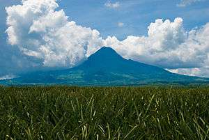
Mount Matutum
Matutum is an active volcano, approximately 5.7 kilometres (3.5 mi) from Acmonan, Tupi, South Cotabato, Philippines.[3][4]
| Matutum | |
|---|---|
 | |
| Highest point | |
| Elevation | 2,286 m (7,500 ft) |
| Prominence | 1,950 m (6,400 ft) [1] |
| Listing |
|
| Coordinates | 6°26′00″N 125°06′30″E [2][1] |
| Geography | |
.svg.png) Matutum .svg.png) Matutum | |
| Country | Philippines |
| Region | SOCCSKSARGEN |
| Province | South Cotabato |
| City/municipality | Tupi |
| Parent range | Hamiguitan Mountain Range |
| Geology | |
| Mountain type | Stratovolcano |
| Volcanic arc/belt | Cotabato Arc |
| Last eruption | 1911 |
| Climbing | |
| |
Location
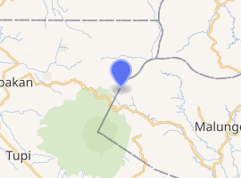
Matutum is located in the province of South Cotabato, on the island of Mindanao, in the south of the Philippines, at geographical coordinates 6°22'N, 125°06.5'E.[2]
It is 15 kilometres (9.3 mi) north of Polomolok, and about 30 kilometres (19 mi) north-northwest of General Santos City.
Physical features
Matutum is a stratovolcano that rises 2,286 metres (7,500 ft) asl with a base diameter of 25 kilometres (16 mi).[4]
It has 2 hot springs, called Acmonan and Linan, 5.7 kilometres (3.5 mi) west-southwest of the volcano.
Adjacent volcanic edifices are Landayao, Tampad, and Albulhek, which are all west of the volcano, and Magolo to the north.
There is a well-preserved 320-metre (1,050 ft) wide crater at the volcano's summit. The crater is breached by three gorges and has a 120-metre (390 ft) deep, densely forested floor.[2]
Eruptions
Volcanologists suspect that Matutum may have had a phreatic eruption on March 7, 1911.[4]
Matutum is one of the active volcanoes in the Philippines. All are part of the Pacific ring of fire.
See also
References
- de Ferranti, Jonathan; Maizlish, Aaron. "Philippine Mountains – 29 Mountain Summits with Prominence of 1,500 meters or greater". Retrieved January 9, 2009.
- "Matutum". Global Volcanism Program. Smithsonian Institution. Retrieved April 10, 2019.
- "List of Active Volcanoes in the Philippines (PHIVOLCS)". Philippine Institute of Volcanology and Seismology. Archived from the original on March 21, 2009. Retrieved January 28, 2009.
- "Mount Matutum Profile on PHIVOLCS". Philippine Institute of Volcanology and Seismology. Archived from the original on January 17, 2010. Retrieved April 10, 2019.
External links
- Philippine Institute of Volcanology and Seismology (PHIVOLCS) Matutum Volcano Page (archived)
- "Matutum". Global Volcanism Program. Smithsonian Institution.