Matakana Island
Matakana Island is located in the western Bay of Plenty in New Zealand's North Island. A long, flat barrier island, it is 20 kilometres (12 mi) in length but rarely more than 3 kilometres (1.9 mi) wide. The island has been continuously populated for centuries by Māori tribes that are mostly associated with Ngāi Te Rangi.
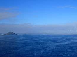 Matakana Island Aotearoa New Zealand from the North | |
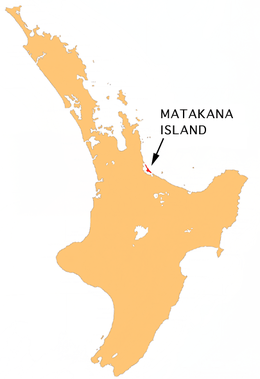 Location of Matakana Island | |
| Geography | |
|---|---|
| Location | Bay of Plenty Region |
| Coordinates | 37°35′S 176°05′E |
| Total islands | 5 |
| Area | 60.7 km2 (23.4 sq mi) |
| Length | 20 km (12 mi) |
| Width | 3 km (1.9 mi) |
| Highest elevation | 18 m (59 ft) |
| Administration | |
| Demographics | |
| Population | 255 (2013 census) |
| Pop. density | 4.2/km2 (10.9/sq mi) |
| Ethnic groups | Maori |
The island has two distinct parts: 5,000 acres (2,023 ha) of farm and orchard land on the inner harbour, (where most of the population lives) and 10,000 acres (4,047 ha) of forest-covered coastal land exposed to the Pacific Ocean. A smaller island, Rangiwaea Island, is located just offshore from Matakana's southern coast.
As of the 2013 census, the island has a population of 255 people, up from 225 people in the 2006 Census.[1] This makes Matakana Island the third least populated area in the Western Bay of Plenty. There are only 90 inhabited dwellings.[2] Most persons living on the island belong to the Ratana Church or the Catholic Church,
History and culture
Recent history
Between 1993 and 1999 the ownership of Matakana Island's 10,000 acres (4,047 ha) forest and freehold land was in dispute. The case Arklow Investments Limited and Christopher Wingate v I.D. MacLean and others was appealed the New Zealand High Court to the Judicial Committee of the Privy Council in London.[3]
Marae
Matakana Island has three marae affiliated with Ngāi Te Rangi hapū. Kutaroa Marae and its Tauaiti meeting house are affiliated with Ngāti Tauaiti. Opureora Marae and its Tuwhiwhia meeting house are affiliated with Ngāi Tuwhiwhia and Ngāti Tauaiti. Te Rangihouhiri or Oruarahi Marae and its Te Rangihouhiri meeting house are affiliated with Ngāi Tamawhariua.[4][5]
There is also two marae sites on neighbouring Rangiwaea Island belonging to Ngāi Te Rangi hapū. Rangiwaea Marae and its meeting house, Te Haka a Te Tupere, are a meeting place for Ngāi Tauwhao. The Oponui Marae site, which was dismantled between the 1980s and 2007, was traditionally a meeting place for Te Ngare.[4][6]
Geography
The island protects the entrance to the Tauranga harbour and stretches from Bowentown to Mount Maunganui.[7] Matakana Island is largely covered with pine trees although some land is cleared for the residents. Matakana Island has a relatively small population density of 4.2, though still more than the West Coast(1.3 as of the 2006 Census).[8] The island is the third largest by area associated with the North Island, or the fifteenth largest within New Zealand waters.
The island's long, white sandy beach is popular with surfers. Surfers can either catch a water taxi from Mount Maunganui or paddle to the island across the mouth of Tauranga Harbour (depending on weather conditions). Matakana's surf side is a nesting site for a large number of sea birds, including the endangered New Zealand dotterel.[9] In 2007 the New Zealand Fisheries Management Research Database recorded and estimated that there were 325 sting rays inhabiting the estuarial waters between Matakana Island and Rangiwaea Island.
Education
Te Kura o Te Moutere o Matakana is a co-educational Māori language immersion state primary school for Year 1 to 8 students,[10] with a roll of 34 as of March 2020.[11]
See also
References
- http://www.sunlive.co.nz/mobile/news/55970-more-than-6000-pyes-pa.html
- "Census 2006". Western Bay of Plenty District Council.
- "Arklow Investments Limited and "Christopher Wingate v I.D. MacLean and others" (PDF). Judicial Committee of the Privy Council. 1 December 1999. Archived from the original (PDF) on 11 June 2011. Retrieved 24 August 2010.
- "Te Kāhui Māngai directory". tkm.govt.nz. Te Puni Kōkiri.
- "Māori Maps". maorimaps.com. Te Potiki National Trust.
- "Tauwhao-Te Ngare Trust Cultural Values Assessment" (PDF). westernbay.govt.nz. Boffa Miskell Limited.
- http://tauranga.kete.net.nz/tauranga_local_history/topics/show/219-matak
- http://m.stats.govt.nz/browse_for_stats/people_and_communities/housing/housing-indicators/2-living-density?sc_device=default
- http://www.tikitouring.co.nz/bop-tauranga-watertaxi.htm
- "Te Kura o Te Moutere o Matakana Ministry of Education School Profile". educationcounts.govt.nz. Ministry of Education.
- "Te Kura o Te Moutere o Matakana Education Review Office Report". ero.govt.nz. Education Review Office.
External links
| Wikimedia Commons has media related to Matakana Island. |