Matad
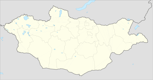
Matad (Mongolian: Матад) is a sum (district) of Dornod Province in eastern Mongolia. The population of the sum as of 2009 is 2,526, of which 834 live in the sum center. The area of the sum is 22,831 km² and the population density is 0.11 people/km².[1]
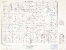
Matad (1956)
Matad District Матад сум ᠮᠠᠲᠠᠳᠰᠤᠮᠤ | |
|---|---|
 Matad District | |
| Coordinates: 46°57′7″N 115°17′34″E | |
| Country | Mongolia |
| Province | Dornod Province |
| Time zone | UTC+8 (UTC + 8) |
Climate
Matad has a semi-arid climate (Köppen climate classification BSk) with warm summers and severely cold winters. Most precipitation falls in the summer as rain, with some snow in autumn and spring. Winters are very dry.
| Climate data for Matad | |||||||||||||
|---|---|---|---|---|---|---|---|---|---|---|---|---|---|
| Month | Jan | Feb | Mar | Apr | May | Jun | Jul | Aug | Sep | Oct | Nov | Dec | Year |
| Record high °C (°F) | 2.5 (36.5) |
7.9 (46.2) |
20.7 (69.3) |
27.5 (81.5) |
37.1 (98.8) |
40.8 (105.4) |
40.2 (104.4) |
39.4 (102.9) |
36.5 (97.7) |
28.2 (82.8) |
16.0 (60.8) |
3.0 (37.4) |
40.8 (105.4) |
| Average high °C (°F) | −14.5 (5.9) |
−10.0 (14.0) |
−1.1 (30.0) |
10.2 (50.4) |
18.4 (65.1) |
24.0 (75.2) |
26.3 (79.3) |
24.5 (76.1) |
17.8 (64.0) |
9.1 (48.4) |
−3.1 (26.4) |
−11.0 (12.2) |
7.6 (45.6) |
| Daily mean °C (°F) | −20.8 (−5.4) |
−18.3 (−0.9) |
−8.6 (16.5) |
2.6 (36.7) |
11.4 (52.5) |
17.9 (64.2) |
20.5 (68.9) |
18.3 (64.9) |
10.8 (51.4) |
1.7 (35.1) |
−9.6 (14.7) |
−17.7 (0.1) |
0.7 (33.2) |
| Average low °C (°F) | −24.4 (−11.9) |
−21.9 (−7.4) |
−13.9 (7.0) |
−4.6 (23.7) |
3.1 (37.6) |
10.3 (50.5) |
13.7 (56.7) |
11.9 (53.4) |
4.8 (40.6) |
−4.2 (24.4) |
−13.9 (7.0) |
−20.8 (−5.4) |
−5.0 (23.0) |
| Record low °C (°F) | −41.5 (−42.7) |
−40.7 (−41.3) |
−34 (−29) |
−19.2 (−2.6) |
−11.0 (12.2) |
−0.9 (30.4) |
4.4 (39.9) |
1.4 (34.5) |
−6.6 (20.1) |
−20.2 (−4.4) |
−30.9 (−23.6) |
−37.9 (−36.2) |
−41.5 (−42.7) |
| Average precipitation mm (inches) | 1.9 (0.07) |
2.3 (0.09) |
3.1 (0.12) |
7.0 (0.28) |
13.7 (0.54) |
31.7 (1.25) |
41.8 (1.65) |
50.4 (1.98) |
23.8 (0.94) |
8.5 (0.33) |
3.9 (0.15) |
2.4 (0.09) |
190.5 (7.49) |
| Average precipitation days (≥ 1.0 mm) | 0.6 | 1.1 | 1.0 | 2.2 | 3.6 | 6.7 | 10.4 | 12.4 | 5.4 | 1.6 | 1.1 | 0.9 | 47 |
| Source: NOAA (1975-1990) [2] | |||||||||||||
gollark: I definitely need you to reverse engineer #3, since I didn't write it, so do that.
gollark: Everyone knows that the best C programmers forego dynamic memory allocation.
gollark: What about the other FORTHy define one?
gollark: Basically, I used osmarkslisp™ to implement a depth first search to find the optimal program to SIMD bubblemergesort a list of arbitrary geometrically distributed integers.
gollark: I finished my entry before the contest even began.
References
- "2009 Annual Report". Dornod Aimag Statistical Office. Archived from the original on 29 April 2012. Retrieved 14 January 2013.
- "Matad Climate Normals 1975-1990". National Oceanic and Atmospheric Administration. Retrieved January 14, 2013.

This article is issued from Wikipedia. The text is licensed under Creative Commons - Attribution - Sharealike. Additional terms may apply for the media files.