Mata, Rio Grande do Sul
Mata is a municipality in Rio Grande do Sul in Brazil.
Mata | |
|---|---|
 | |
 Flag  Seal | |
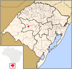 Location in Rio Grande do Sul, Brazil | |
 Mata Location in Brazil | |
| Coordinates: 29°33′57″S 54°27′36″W | |
| Country | Brazil |
| Region | South |
| State | Rio Grande do Sul |
| Government | |
| • Mayor | Sergio Roni Bruning |
| Area | |
| • Total | 312.120 km2 (120.510 sq mi) |
| Elevation | 127 m (417 ft) |
| Population (2010) | |
| • Total | 5,111 |
| • Density | 16/km2 (42/sq mi) |
| Time zone | UTC-3 (UTC-3) |
| • Summer (DST) | UTC-2 (UTC-2) |
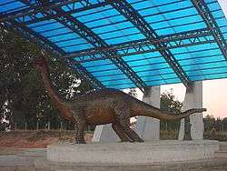
Paleontology
The city of Mata has large deposits of petrified trees.
Museum of the city that have fossils:
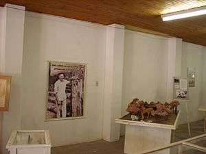
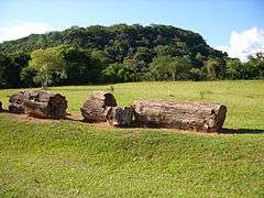 Petrified wood in the Paleobotanic Park
 São Roque community
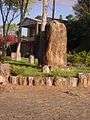
gollark: VPSes are basically generic virtual servers - pretty cheap and probably more powerful than shared hosting stuff, but also requiring more configuration.
gollark: I'm sticking a static-site-generated "other interesting blogs" bit on too soon.
gollark: I hear Digital Ocean is good?
gollark: I run my website (https://osmarks.tk/) off an old server at home, but you can rent a VPS or something quite cheaply.
gollark: Which fonts specifically?
References
External links


This article is issued from Wikipedia. The text is licensed under Creative Commons - Attribution - Sharealike. Additional terms may apply for the media files.