Martin Hotine
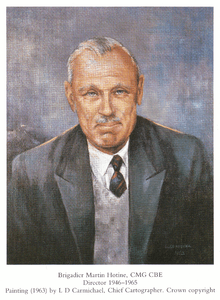
Brigadier Martin Hotine CMG CBE (17 June 1898 – 12 November 1968)[3] was the head of the Trigonometrical and Levelling Division of the Ordnance Survey responsible for the 26-year-long retriangulation of Great Britain[4] (1936–1962) and was the first Director General of the Directorate of Overseas Surveys (1946–1985).[5]
Brigadier Martin Hotine CMG CBE | |
|---|---|
 | |
| Born | 17 June 1898[1] Wandsworth, London[2] |
| Died | 12 November 1968 (aged 70)[1] Surrey, England |
| Resting place | Municipal Cemetery, Weybridge, Surrey, England 51.366442°N 0.465578°W |
| Nationality | British |
| Education | Southend Technical School (now SHSB)[2] Magdalene College, Cambridge[2] |
| Known for | Founder and first Director General of the Directorate of Overseas Surveys |
| Spouse(s) | Kate Amelia Hotine (1895–1987) |
He served on the North-West Frontier during the First World War and later in the Persian and Mesopotamian campaigns. He has been described as "decisive, ingenious and tough".[4]
Retriangulation of Great Britain
Hotine was responsible for the design of the triangulation pillars constructed during the Geodetic resurvey of Britain.[4] 6,173 of these were built.[4] They provided a solid base for the theodolites used by the survey teams during the survey, thereby improving the accuracy of the readings obtained.[4] They are sometimes referred to as "Hotine Pillars".
Personal life
Hotine was married to Kate Amelia Hotine (née Pearson)(1895–1987) whose nickname to family and friends was 'Ajax'.[3]
Honours
- 1947 Royal Geographical Society Founder's Gold Medal "For research work in Air Survey ... and for his cartographic work."[6]
- 1955 Photogrammetric Society's first President's Medal[5]
- 1964 The Institution of Royal Engineers' Gold Medal[5]
Publications
- Hotine, Martin (1931), Surveying from air photographs, Professional Papers of the Air Survey Committee – No. 3, London: His Majesty's Stationery Office, p. 71
- Hotine, Martin (1931), The Fourcade Stereogoniometer, Professional Papers of the Air Survey Committee – No. 7, London: His Majesty's Stationery Office, OCLC 184739773
- Hotine, Martin, Mathematical geodesy
References
- Edge, R C A (March 1969). "Bulletin Géodésique". Bulletin Géodésique. Springer Berlin / Heidelberg. 91 (1): 8–12. doi:10.1007/bf02524840. ISSN 0007-4632.
- Humphries, G J (March 1969). "Martin Hotine obituary". The Geographical Journal. Royal Geographical Society. 135 (1): 156–157. JSTOR 1795667.
- "Martin Hotine grave monument details". Gravestone photographic resource. Gravestone Photographic Resource. Retrieved 24 January 2010.
- Crane, Nicholas (30 October 2004). "Britain: Master of all he surveys". The Daily Telegraph. London, England: Telegraph Media Group Limited. Retrieved 24 January 2010.
- Macdonald, Alastair (1996). Mapping The World (1st ed.). Norwich, England: HMSO. pp. ii. ISBN 0-11-701590-3.
- List of Past Royal Geographical Society Gold Medal Winners
| Authority control |
|
|---|