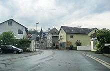
Marktleugast
Marktleugast is a municipality in the district of Kulmbach in Bavaria in Germany.
Marktleugast | |
|---|---|
 Coat of arms | |
Location of Marktleugast within Kulmbach district 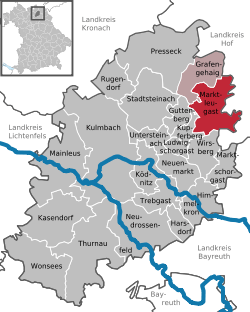 | |
 Marktleugast  Marktleugast | |
| Coordinates: 50°10′N 11°37′E | |
| Country | Germany |
| State | Bavaria |
| Admin. region | Oberfranken |
| District | Kulmbach |
| Municipal assoc. | Marktleugast |
| Subdivisions | 23 Ortsteile |
| Government | |
| • Mayor | Franz Uome |
| Area | |
| • Total | 33.89 km2 (13.09 sq mi) |
| Highest elevation | 627 m (2,057 ft) |
| Lowest elevation | 544 m (1,785 ft) |
| Population (2018-12-31)[1] | |
| • Total | 3,139 |
| • Density | 93/km2 (240/sq mi) |
| Time zone | CET/CEST (UTC+1/+2) |
| Postal codes | 95352 |
| Dialling codes | 09255 |
| Vehicle registration | KU |
| Website | www.marktleugast.de |
Geography
Marktleugast is located on the southeastern edge of the Frankenwald Nature Park.
City arrangement
Marktleugast
Marktleugast is arranged in the following boroughs:
- Baiersbach
- Filshof
- Großrehmühle
- Hanauerhof
- Hermes
- Hinterrehberg
- Hohenberg
- Hohenreuth
- Kleinrehmühle
- Kosermühle
- Mannsflur
- Marienweiher
- Marktleugast
- Mittelrehberg
- Neuensorg
- Ösel
- Roth
- Steinbach
- Tannenwirtshaus
- Traindorf
- Vorderrehberg
- Weihermühle
- Zegastmühle
Towns and municipalities in Kulmbach (district) | ||
|---|---|---|
gollark: Fascinating.
gollark: Probably 3 hours at most.
gollark: Indeed.
gollark: If we look at LyricLy's diagram, it seems like it might be more than 2 hours off sometimes.
gollark: You're still not measuring actual *local* solar position, which you seemed to suggest that people needed. It's generally close, but it's affected by political factors a lot.
References
- "Fortschreibung des Bevölkerungsstandes". Bayerisches Landesamt für Statistik und Datenverarbeitung (in German). July 2019.
| Authority control |
|
|---|
This article is issued from Wikipedia. The text is licensed under Creative Commons - Attribution - Sharealike. Additional terms may apply for the media files.