Mark Twain/I-70 Industrial, St. Louis
Mark Twain/I-70 Industrial is a neighborhood of St. Louis, Missouri. It is bound by I-70 to the north, North Kingshighway to the east, Natural Bridge Road to the south, and the city limit to the west.
Mark Twain/I-70 Industrial | |
|---|---|
Neighborhood of St. Louis | |
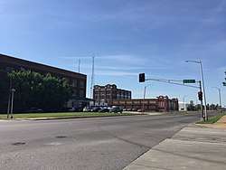 Mark Twain/I-70 Industrial in May 2018. View from Union Boulevard and Brown intersection facing south. | |
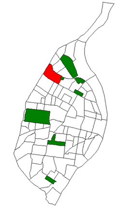 Location of Mark Twain I-70 Industrial within St. Louis | |
| Country | United States |
| State | Missouri |
| City | St. Louis |
| Wards | 22 |
| Area | |
| • Total | 1.21 sq mi (3.1 km2) |
| Population (2010)[1] | |
| • Total | 1,295 |
| • Density | 1,100/sq mi (410/km2) |
| ZIP code(s) | Part of 63115, 63120 |
| Area code(s) | 314 |
| Website | stlouis-mo.gov |
Demographics
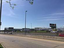
View of Mark Twain/I-70 Industrial as seen from Bircher Boulevard. I-70 is visible as well.
In 2010 Mark Twain/I-70 Industrial's racial makeup was 95.8% Black, 2.4% White, 0.5% Two or More Races, and 1.2% Some Other Race. 1.9% of the population was of Hispanic or Latino origin.[2]
gollark: Pjals mode, yes.
gollark: If I did have cancer, which I don't (probably), I would find that *extremely* uncalled-for and unacceptable.
gollark: Huh, the indents are weirdly broken.
gollark: PotatOS ships with a built-in prime factorization tool too now!
gollark: https://git.osmarks.net/osmarks/potatOS/src/branch/master/src/main.lua#L524
References
- Census Summary By Neighborhoods Archived 2009-09-02 at the Wayback Machine
- "Archived copy". Archived from the original on 2012-05-16. Retrieved 2012-08-17.CS1 maint: archived copy as title (link)
This article is issued from Wikipedia. The text is licensed under Creative Commons - Attribution - Sharealike. Additional terms may apply for the media files.