Margalef
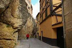
Margalef is a village in Catalonia, Spain. It is situated on the edge of Montsant and is a popular ecotourism destination, especially among rock climbers. The rock type is conglomerate and it has more than 500 climbing routes of different grades, from 4 to 9b+.[4][5] Many of the buildings in the village are also built on conglomerate formations.
Margalef | |
|---|---|
 | |
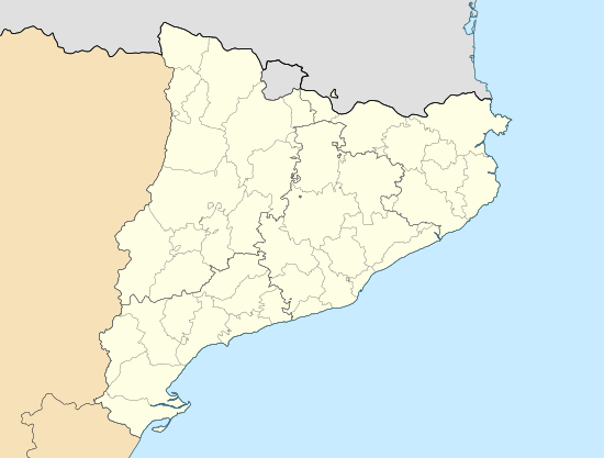 Margalef Location in Catalonia | |
| Coordinates: 41°17′7″N 0°45′15″E | |
| Country | |
| Autonomous community | |
| Province | Tarragona |
| Comarca | Priorat |
| Government | |
| • mayor | Joaquim Vila Gibert (2015)[1] |
| Area | |
| • Total | 34.7 km2 (13.4 sq mi) |
| Elevation | 379 m (1,243 ft) |
| Population (2018)[3] | |
| • Total | 94 |
| • Density | 2.7/km2 (7.0/sq mi) |
| Demonym(s) | Margalefà, margalefana |
| Website | margalef |
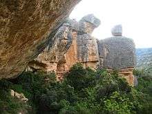
Rocks and climbing routes in Margalef
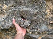
Forat hold on a Conglomerate rock in Margalef
Margalef's important economic activity is agriculture, mainly producing olives, almonds, and fruits.
References
- "Ajuntament de Margalef". Generalitat of Catalonia. Retrieved 2015-11-13.
- "El municipi en xifres: Margalef". Statistical Institute of Catalonia. Retrieved 2015-11-23.
- Municipal Register of Spain 2018. National Statistics Institute.
- "Margalef, Catalonia, Spain climbing". www.planetmountain.com.
- "Margalef - Zona del Panta North". www.ukclimbing.com.
External links
Places adjacent to Margalef | |
|---|---|
This article is issued from Wikipedia. The text is licensed under Creative Commons - Attribution - Sharealike. Additional terms may apply for the media files.