Maoluo River
The Maoluo River (Chinese: 貓羅溪; pinyin: Māoluó Xī; Wade–Giles: Mao1-lo2 Hsi1)[2] is a tributary of the Wu River (Dadu River) in Taiwan.[3] It is the main tributary on the left bank of the Wu River.[1][4] Originating from the Jialishan Range, it flows east of the Bagua Plateau through Nantou County, Changhua County, and Taichung City for 47 kilometers.[1]
| Maoluo River | |
|---|---|
 | |
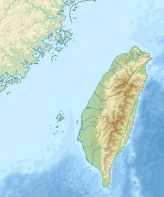 Map showing the mouth of Maoluo River at its confluence with the Wu River | |
| Location | |
| Country | Taiwan |
| Physical characteristics | |
| Source | |
| • location | Jiufener Mountain (九份二山), Jialishan Range |
| • coordinates | 23.9358°N 120.8317°E |
| • elevation | 1,178 m (3,865 ft) |
| Mouth | |
• location | Wu River at Wuri, Taichung |
• coordinates | 24.0603°N 120.6277°E |
| Length | 47 km (29 mi)[1] |
| Basin size | 377 km2 (146 sq mi)[1] |
| Basin features | |
| River system | Wu River |
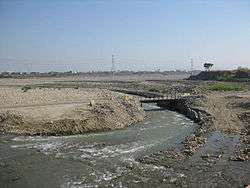
The mouth of the Maoluo River.
See also
- List of rivers in Taiwan
References
- 治理計畫--烏溪(Wu River) [Governance project: Wu River] (in Chinese). Water Resources Agency, Ministry of Economic Affairs. Archived from the original on 9 August 2016. Retrieved 20 June 2016.
- "GeoNames Search". Geographic Names Database. National Geospatial-Intelligence Agency, USA. Retrieved 20 June 2016.
- "Wu River" (in Chinese). Water Resources Agency, Ministry of Economic Affairs. Archived from the original on 29 October 2015. Retrieved 20 June 2016.
- Chen, Wei-Bo; Liu, Wen-Cheng; Wu, Chung-Yi (2013). "Coupling of a one-dimensional river routing model and a three-dimensional ocean model to predict overbank flows in a complex river–ocean system". Applied Mathematical Modelling. 37 (9): 6163–6176. doi:10.1016/j.apm.2013.01.003.
| Wikimedia Commons has media related to Maoluo River. |
This article is issued from Wikipedia. The text is licensed under Creative Commons - Attribution - Sharealike. Additional terms may apply for the media files.