Mangataboahangy
Mangataboahangy is a town and commune in Madagascar. It belongs to the district of Ambatofinandrahana, which is a part of Amoron'i Mania Region. The population of the commune was estimated to be approximately 8,000 in 2001 commune census.[2]
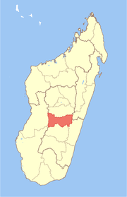
Mangataboahangy | |
|---|---|
 Mangataboahangy Location in Madagascar | |
| Coordinates: 20°16′S 46°12′E | |
| Country | |
| Region | Amoron'i Mania |
| District | Ambatofinandrahana |
| Elevation | 1,092 m (3,583 ft) |
| Population (2001)[2] | |
| • Total | 8,000 |
| Time zone | UTC3 (EAT) |
Only primary schooling is available. It is also a site of industrial-scale mining. The majority 95% of the population of the commune are farmers. The most important crop is rice, while other important products are peanuts, beans, maize and cassava. Services provide employment for 5% of the population.[2]
References and notes
- Estimated based on DEM data from Shuttle Radar Topography Mission
- "ILO census data". Cornell University. 2002. Retrieved 2008-05-11.
gollark: ++magic reload radio_ext
gollark: Forward motion?
gollark: Oh no.
gollark: ++radio connect main 826930056432451595
gollark: ++magic reload_ext voice
This article is issued from Wikipedia. The text is licensed under Creative Commons - Attribution - Sharealike. Additional terms may apply for the media files.