Mallambray (Parish), New South Wales
Mallambray (Parish), in Central Darling Shire is a remote rural locality and civil parish of Yungnulgra County in far North West New South Wales.[1][2]
Geography
The Parish has an arid landscape. The parish has a Köppen climate classification of BWh (Hot desert),.[3] is almost unpopulated, with less than two inhabitants per square kilometer.[4] The nearest town is Whitecliffs to the north.
Climate
The parish has extremely hot summers and mild winters. Summers would usually exceed 36 °C. Winters are usually around 17 °C. The annual average rainfall is 249.7 millimetres (9.8 in) which would make it a semi-arid climate except that its high evapotranspiration, or its aridity, makes it a desert climate.
History
The Parish is on the traditional lands of the Wandjiwalgu.[5][6] Aboriginal peoples.[7]
In 1838 Thomas Mitchell (explorer) travelled down the nearby Darling River.
Charles Sturt passed through the Wandjiwalgu lands during 1845,[8]
In 1861 the Burke and Wills expedition passed nearby.[9]
Opal was discovered in the area in the late 19th century.
References
- "Yungnulgra". Geographical Names Register (GNR) of NSW. Geographical Names Board of New South Wales. Retrieved 30 July 2013.

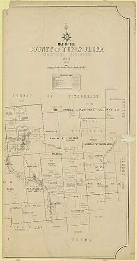
- Historic map of Yungnulgra County.
- Peel, M. C.; Finlayson, B. L.; McMahon, T. A. (2007). "Updated world map of the Köppen–Geiger climate classification". Hydrol. Earth Syst. Sci. 11: 1633–1644. doi:10.5194/hess-11-1633-2007. ISSN 1027-5606. (direct: Final Revised Paper)
- NASA Earth Observations: Population Density”. NASA/SEDAC..
- David R Horton,Aboriginal Studies Press, AIATS and Sinclair Merz Knight 1996
- Tindale, Norman Barnett (1974). Aboriginal Tribes of Australia: Their Terrain, Environmental Controls, Distribution, Limits, and Proper Names. Australian National University Press. p196.
- David R Horton (creator), Aboriginal Studies Press, AIATSIS, and Auslig/Sinclair Knight Merz, 1996.
- Sturt's Central Australian Expedition Archived 1 March 2018 at the Wayback Machine.
- The Burke and Wills Expedition Archived 1 March 2018 at the Wayback Machine.