Maleshevo Cove
Maleshevo Cove (Bulgarian: залив Малешево, romanized: zaliv Maleshevo, IPA: [ˈzalif mɐˈlɛʃɛvo]) is a 2.5 km wide cove indenting for 1.1 km the north coast of Livingston Island in the South Shetland Islands, Antarctica. It is entered between Lukovit Point and Siddins Point.
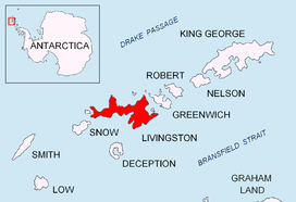
Location of Livingston Island in the South Shetland Islands.
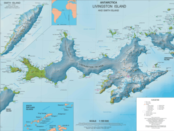
Topographic map of Livingston Island and Smith Island.
The cove is named after the Maleshevo region in southwestern Bulgaria.
Location
Maleshevo Cove is located at 62°33′36″S 60°26′36″W. A Spanish mapping was done in 1991 and Bulgarian ones in 2005 and 2009.
Map
- L.L. Ivanov. Antarctica: Livingston Island and Greenwich, Robert, Snow and Smith Islands. Scale 1:120000 topographic map. Troyan: Manfred Wörner Foundation, 2009. ISBN 978-954-92032-6-4
gollark: Yes. Factorials can be extended to real numbers in many ways.
gollark: Don't worry, I rebound π as that gamma constant.
gollark: Lyricly doesn't know that I really made #π.
gollark: Those do nothing, you realise.
gollark: I wrote all of them! Even the antimemetic ones!
References
- Maleshevo Cove. SCAR Composite Gazetteer of Antarctica.
- Bulgarian Antarctic Gazetteer. Antarctic Place-names Commission. (details in Bulgarian, basic data in English)
External links
- Maleshevo Cove. Copernix satellite image
This article includes information from the Antarctic Place-names Commission of Bulgaria which is used with permission.
This article is issued from Wikipedia. The text is licensed under Creative Commons - Attribution - Sharealike. Additional terms may apply for the media files.