Londerzeel
Londerzeel (Dutch pronunciation: [ˈlɔndərzeːl]) is a municipality located in the Belgian province of Flemish Brabant. The municipality comprises the towns of Londerzeel proper, Malderen, Steenhuffel (home of Palm Breweries) and Sint-Jozef. On 1 January 2006, Londerzeel had a total population of 17,435. The total area is 36.29 km² which gives a population density of 480 inhabitants per km².
Londerzeel | |
|---|---|
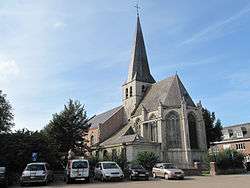 Steenhuffel church | |
 Flag  Coat of arms | |
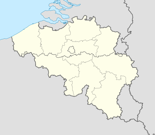 Londerzeel Location in Belgium
Location of Londerzeel in Flemish Brabant 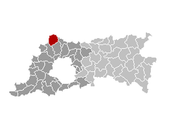 | |
| Coordinates: 51°00′N 04°18′E | |
| Country | Belgium |
| Community | Flemish Community |
| Region | Flemish Region |
| Province | Flemish Brabant |
| Arrondissement | Halle-Vilvoorde |
| Government | |
| • Mayor | Conny Moons (LWD) |
| • Governing party/ies | CD&V, LWD, Groen) |
| Area | |
| • Total | 36.29 km2 (14.01 sq mi) |
| Population (2018-01-01)[1] | |
| • Total | 18,620 |
| • Density | 510/km2 (1,300/sq mi) |
| Postal codes | 1840 |
| Area codes | 052, 015 |
| Website | www.londerzeel.be |
Their football team is K. Londerzeel S.K..
Notable people
- Gerard Walschap (b. Londerzeel-St. Jozef, 9 July 1898-Antwerp, 25 October 1989), writer.
- Kris Van Assche, fashion designer.
Twin towns
Londerzeel has been twinned with Gladenbach (Germany) since 2010.
gollark: `debug.getfenv` might be able to do it but please don't.
gollark: And you can open all modems just by doing `peripheral.find("modem", rednet.open)`.
gollark: You just pass them as arguments and it works.
gollark: No, your connection is fine, Discord would say if a message had not actually sent.
gollark: And send the events on the connections somehow.
References
- "Wettelijke Bevolking per gemeente op 1 januari 2018". Statbel. Retrieved 9 March 2019.
External links

- Official website (in Dutch)
- Palm- Available only in Dutch and French
Places adjacent to Londerzeel | ||||||||||
|---|---|---|---|---|---|---|---|---|---|---|
| ||||||||||

This article is issued from Wikipedia. The text is licensed under Creative Commons - Attribution - Sharealike. Additional terms may apply for the media files.