Malad River (Gooding County, Idaho)
The Malad River is river located entirely within Gooding County, Idaho, United States, and is a tributary of the Snake River.
| Malad River Big Wood River, Riviera Malades, Sickly River | |
|---|---|
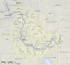
 Map of the Snake River watershed including the Malad River | |
| Location | |
| Country | United States |
| State | Idaho |
| Region | Gooding County |
| Physical characteristics | |
| Source | Confluence of the Big Wood River & Little Wood River |
| • coordinates | 42°56′42″N 114°47′46″W[1] |
| • elevation | 3,460 ft (1,050 m)[2] |
| Mouth | Snake River |
• coordinates | 42°51′45″N 114°54′18″W[1] |
• elevation | 2,703 ft (824 m)[2] |
| Length | 12.0 mi (19.3 km)[3] |
| Basin size | 3,000 sq mi (7,800 km2)[4] |
| Discharge | |
| • location | near Hagerman[4] |
| • average | 286 cu ft/s (8.1 m3/s)[4] |
| • minimum | 0 cu ft/s (0 m3/s) |
| • maximum | 6,400 cu ft/s (180 m3/s) |
| Discharge | |
| • location | mouth[4] |
| • average | 112 cu ft/s (3.2 m3/s)[4] |
| Basin features | |
| Tributaries | |
| • left | Little Wood River |
| • right | Big Wood River |
Description
The river is formed by the confluence of the Big Wood River[Note 1] and the Little Wood River near Gooding. From there the river flows south and west for 12.0 miles (19.3 km)[3] to join the Snake River near Hagerman.[1]
The river flows through Thousand Springs State Park, where it tumbles down a stairstep waterfall. The Malad Gorge is 250 feet (76 m) deep and 2.5 miles (4.0 km) long.
The river's flow is affected by numerous reservoirs and irrigation works on its tributaries. The Malad River itself is largely diverted into a power flume that enters the Snake below the mouth of the Malad, via a powerhouse. Below the diversion the Malad River is replenished by numerous springs, yet the average flow above the diversion is higher than at the river's mouth.[4]
The Malad River is part of the Columbia River basin, being a tributary of the Snake River, which is a tributary to the Columbia River.[5]
The name of the river stems from French malade, via Rivière aux Malades ('river of the sick'), presumably as a reference to some illness suffered by early French-Canadian trappers who investigated the area.[6]
Notes
- One of the main tributaries of the Big Wood River is the Camas Creek. What makes that interesting is that one of the tributaries of that Camas Creek (not to be confused with at least four other Camas Creeks in Idaho) is also called the Malad River, thus making that Malad River a tributary of this Malad River.
References
- U.S. Geological Survey Geographic Names Information System: Malad River
- Google Earth elevation for GNIS coordinates.
- U.S. Geological Survey. National Hydrography Dataset high-resolution flowline data. The National Map Archived 2012-04-05 at WebCite, accessed 3 May 2011
- Water Resource Data, Idaho, 2005, USGS.
- Malad River Stage Station slide show "Archived copy". Archived from the original on 2008-07-05. Retrieved 2009-02-23.CS1 maint: archived copy as title (link) Accessed 23 Feb 2009
- George R. Stewart. A Concise Dictionary of American Place-Names.
External links
![]()