Mahan, Missouri
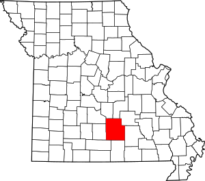
Mahan is an unincorporated community in Texas County, in the U.S. state of Missouri.[1] The community was located on Missouri Route 137 and Missouri Route V, approximately one mile south of Oscar and four miles north of Raymondville.[2] It is at an elevation of 1,309 ft (399 m).[1] The Mahan Cemetery lies about one mile east on Route V.[3]
History
A post office called Mahan was established in 1903, and remained in operation until 1912.[4] An early postmaster gave the community the name of her husband, Sam Mahan.[5]
gollark: Or hesequel.
gollark: .
gollark: Heskill? It's hosqol, I told you
gollark: GHC is, as they say, quite big.
gollark: Of course you might be able to.
References
- U.S. Geological Survey Geographic Names Information System: Mahan, Missouri
- Missouri Atlas & Gazetteer, DeLorme, 1998, First edition, p. 54, ISBN 0-89933-224-2
- Licking, Missouri, 7.5 Minute Topographic Quadrangle, USGS, 1957 (1981 rev)
- "Post Offices". Jim Forte Postal History. Retrieved 28 December 2016.
- "Texas County Place Names, 1928–1945". The State Historical Society of Missouri. Archived from the original on June 24, 2016. Retrieved December 28, 2016.
This article is issued from Wikipedia. The text is licensed under Creative Commons - Attribution - Sharealike. Additional terms may apply for the media files.
