Lower Tregantle
Lower Tregantle is a hamlet in Cornwall, England, UK.[1] It is about half a mile south of Antony; Higher Tregantle is about a quarter of a mile further south.[2] It should be distinguished from Lower Tregantle, a farm near Luxulyan.
| Lower Tregantle | |
|---|---|
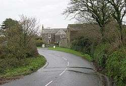 Higher Tregantle Farm | |
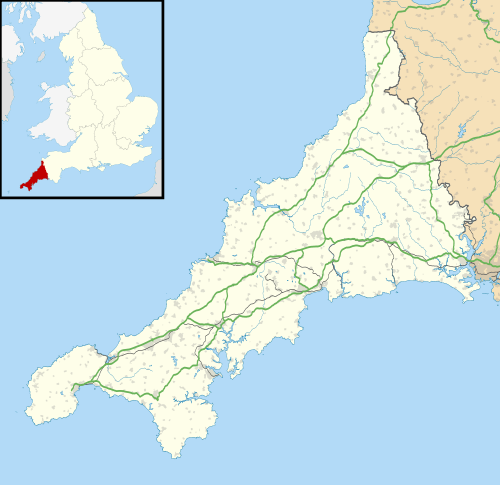 Lower Tregantle Location within Cornwall | |
| OS grid reference | SX391536 |
| Civil parish | |
| Unitary authority | |
| Ceremonial county | |
| Region | |
| Country | England |
| Sovereign state | United Kingdom |
| Post town | Torpoint |
| Postcode district | PL11 3 |
Higher Tregantle Farmhouse is a grade II listed building [3] with part of the house dating back to the 17th century.
See also
References
- Ordnance Survey: Landranger map sheet 201 Plymouth & Launceston (Tavistock & Looe) (Map). Ordnance Survey. ISBN 978-0-319-23287-3.
- Ordnance Survey One-inch Map of Great Britain; Bodmin and Launceston, sheet 186. 1961.
- http://www.britishlistedbuildings.co.uk/en-61663-higher-tregantle-farmhouse-antony-
Cornwall Portal | |
| Unitary authorities | |
| Major settlements |
|
| Rivers | |
| Topics | |
This article is issued from Wikipedia. The text is licensed under Creative Commons - Attribution - Sharealike. Additional terms may apply for the media files.