Long Island (Tennessee)
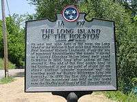
Long Island, also known as Long Island of the Holston, is an island in the Holston River at Kingsport in East Tennessee. Important in regional history since pre-colonial times, the island is listed on the National Register of Historic Places and is designated as a U.S. National Historic Landmark District.
Long Island of the Holston | |
.jpg) Aerial view of the island | |
  | |
| Location | S. Branch Holston River, Kingsport, Tennessee |
|---|---|
| Coordinates | 36°31′49″N 82°33′39″W |
| Area | 840 acres (340 ha)[1] |
| Built | 1760 |
| NRHP reference No. | 66000733 |
| Significant dates | |
| Added to NRHP | October 15, 1966[2] |
| Designated NHLD | October 9, 1960 |
Geography
Long Island is located across the main channel of the South Branch Holston River from downtown Kingsport. It is about 4 miles (6.4 km) in length, and has a maximum width of about 0.5 miles (0.80 km).[1] A secondary channel, known locally as the Sluice, forms the southern border of the island. Bridges carry Tennessee State Route 126 across both channels about 2/3 of the way south on the island, and a third bridge carries Jared Drive to the mainland near its southern tip. The area south of SR 126 is mostly occupied by Eastman Chemical.
History

The Long Island of the Holston River was an important site for the Cherokee, colonial pioneers, and early settlers of the region. It was a sacred council and treaty site among the Cherokee people. The Timberlake Expedition of 1761–62 used it as its point of origin and return. It was from here that Daniel Boone, in 1775, began to clear the Wilderness Road, which extended through the Cumberland Gap into Kentucky.
William Cocke, who had worked with Boone and led fights against the Cherokee, sold the island in 1776 to Samuel Woods but without a right to do so. The 1777 Long Island of the Holston Treaty stated that the Cherokee still owned the land. Thomas Dearborn, Secretary of State to Thomas Jefferson, purchased the island from the Cherokee on January 7, 1806. Richard Netherland, husband of one of Woods' descendants, bought the land from Woods' relatives who succeeded in getting the land back in 1810. He built a plantation and began industries.[3]
A long-standing settlement built at the site was chartered as the town of Kingsport in 1822 and became an important regional shipping port on the Holston River in the early 19th century. Goods brought in from the surrounding countryside were loaded onto barges for transport downstream to the Holston's confluence with the Tennessee River (at Knoxville). The young town lost its charter, however, after a downturn in its fortunes precipitated by the Civil War.
During Prohibition, the island gained a reputation for violence and bootlegging.[4]
Long Island of the Holston was declared a National Historic Landmark in 1960.[1] 3.61 acres described as "Sacred Cherokee ground" obtained in 1806 were returned to the Eastern Band of the Cherokee July 16, 1976.[3] The island, however, has been heavily transformed by industrial development, particularly Eastman Chemical Company.[3] National Park Service staff recommended withdrawal of the National Historic Landmark status in 1996 because of a loss of the island's historic integrity, but the island has retained its Historic Landmark status.
Demographics
Most of the island lies within the corporate boundaries of Kingsport. Long Island's population peaked between 1955 and 1963, holding 517 residences and approximately 1,800 people at the time.[4] There are only a handful of houses on the island as of 2019.
See also
References
- Frank B. Sarles, Jr. & Polly M. Rettig (June 4, 1976). "National Register of Historic Places Inventory-Nomination: Long Island of the Holston" (pdf). National Park Service. Cite journal requires
|journal=(help) and Accompanying seven photos (from 1958, 1972, and 1975) (32 KB) - "National Register Information System". National Register of Historic Places. National Park Service. January 23, 2007.
- Neufeld, Rob (October 28, 2018). "Visiting Our Past: Long Island on the Holston, treaty to treatment". Asheville Citizen-Times. Retrieved October 28, 2018.
- Patricia Bernard Ezzell. "Long Island". Tennessee Encyclopedia on-line article. Tennessee Historical Society. Retrieved September 11, 2011.
Further reading
- Long, Howard. Kingsport: A Romance of Industry. Overmountain Press (October 1993)
- Spoden, Muriel M.C. Kingsport Heritage: The Early Years, 1700 to 1900. Johnson City, TN: The Overmountain Press, 1991
- Spoden, Muriel Millar Clark . The Long Island of the Holston: Sacred island of the Cherokee nation
- Williams, "Fort Robinson on the Holston," East Tennessee Historical Society Publications, no.4 (1932)
- Williams, Samuel C. Dawn of Tennessee Valley and Tennessee History (Johnson City, 1937)
- Williams, Tennessee During the Revolutionary War (Nashville, 1944)
- Wolfe, Margaret Ripley. Kingsport Tennessee: A Planned American City. University Press of Kentucky (November 1987)
External links
- Long Island of the Holston, Tennessee; National Park Service online