Llusco District
Llusco District is one of eight districts of the province Chumbivilcas in Peru.[1]
Llusco Llusk'u | |
|---|---|
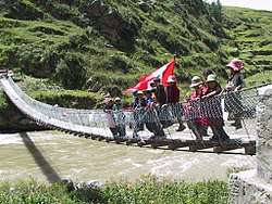 Footbridge across Qañawimayu (or Santo Tomás River) in Qullpatumayku, Llusco District | |
| Country | |
| Region | Cusco |
| Province | Chumbivilcas |
| Founded | January 2, 1857 |
| Capital | Llusco |
| Government | |
| • Mayor | Jesús Rimache Huamani |
| Area | |
| • Total | 315.42 km2 (121.78 sq mi) |
| Elevation | 3,525 m (11,565 ft) |
| Population (2005 census) | |
| • Total | 7,325 |
| • Density | 23/km2 (60/sq mi) |
| Time zone | UTC-5 (PET) |
| UBIGEO | 080706 |
Geography
One of the highest peaks of the district is Qillwa Sirk'a at 4,600 m (15,100 ft). Other mountains are listed below:[2]
- Payrumani
- Puka Marka
- Runa Runa
- Urquni
- Yana P'unqu
- Yuraq Urqu
Ethnic groups
The people in the district are mainly indigenous citizens of Quechua descent. Quechua is the language which the majority of the population (97.65%) learnt to speak in childhood, 2.27% of the residents started speaking using the Spanish language (2007 Peru Census).[3]
gollark: Wondrous.
gollark: fine.
gollark: Apiobeeses, how the apiological bees does this WORK?
gollark: I assumed there were more.
gollark: +>inv
See also
References
- (in Spanish) Instituto Nacional de Estadística e Informática. Banco de Información Distrital Archived 2008-04-23 at the Wayback Machine. Retrieved April 11, 2008.
- escale.minedu.gob.pe/ UGEL map Chumbivilcas Province (Cusco Region)
- inei.gob.pe Archived 2013-01-27 at the Wayback Machine INEI, Peru, Censos Nacionales 2007, Frequencias: Preguntas de Población: Idioma o lengua con el que aprendió hablar (in Spanish)
| |
|---|---|
| Acomayo | |
| Anta | |
| Calca | |
| Canas | |
| Canchis | |
| Chumbivilcas | |
| Cusco | |
| Espinar | |
| La Convención | |
| Paruro | |
| Paucartambo | |
| Quispicanchi | |
| Urubamba | |
This article is issued from Wikipedia. The text is licensed under Creative Commons - Attribution - Sharealike. Additional terms may apply for the media files.