Llanddaniel Fab
Llanddaniel Fab (or Llanddaniel-fab) is a village and community in the Welsh county of Isle of Anglesey. At the 2001 census it had a population of 699,[1] increasing to 776 at the 2011 census.[2]
| Llanddaniel Fab | |
|---|---|
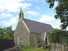
 Saint Deiniol's Church | |
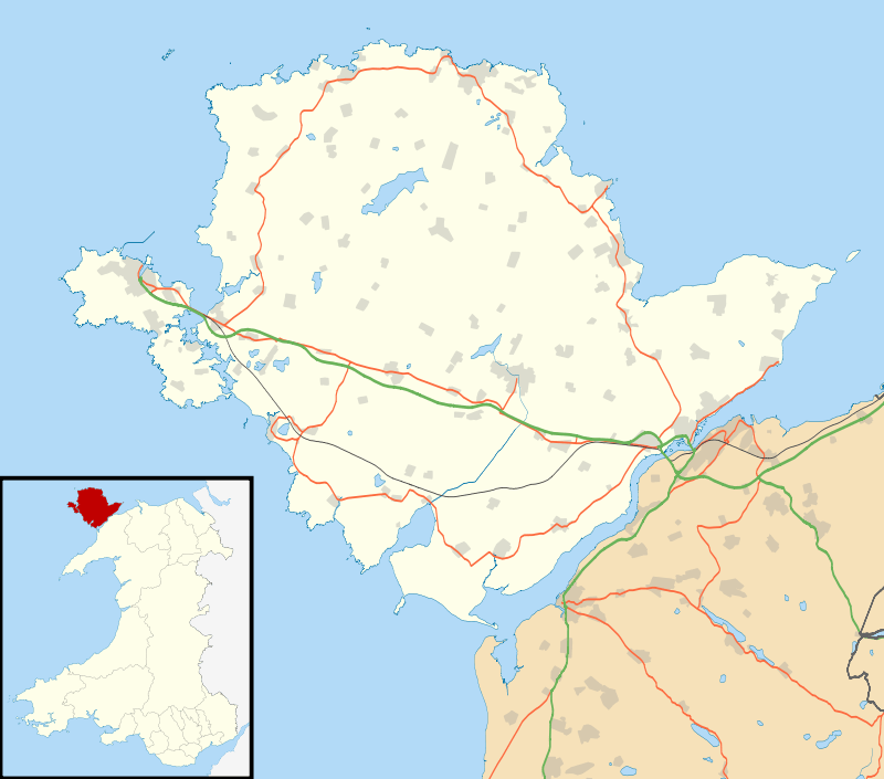
 Llanddaniel Fab Location within Anglesey | |
| Population | 776 (2011) |
| OS grid reference | SH4970 |
| Community |
|
| Principal area | |
| Ceremonial county | |
| Country | Wales |
| Sovereign state | United Kingdom |
| Post town | GAERWEN |
| Postcode district | LL60 |
| Dialling code | 01248 |
| Police | North Wales |
| Fire | North Wales |
| Ambulance | Welsh |
| UK Parliament | |
| Senedd Cymru – Welsh Parliament |
|
It is near the prehistoric monument of Bryn Celli Ddu which was constructed in the late neolithic period. In the east of the community, by the Menai Strait, stands the country seat of the Marquess of Anglesey, Plas Newydd, parts of which date from the 14th century. The house has been owned by the National Trust since 1976.
During the 2001 United Kingdom foot-and-mouth crisis, many sheep and cattle were slaughtered in the area.[3]
The village has its own community council and its county council representative is Hywel Eifion Jones, who has held the post since May 1999. Amenities include a post office, primary school (Ysgol Parc y Bont), and a 12-hole golf course.[4]
Probably the village's most famous son is Tecwyn Roberts (1925-1988), who became NASA’s first Flight Dynamics Officer with Project Mercury that put the first American into space. Roberts was born at Trefnant Bach cottage in Llanddaniel Fab and was a former pupil of Ysgol Parc y Bont. After serving as a member of the Avro Arrow project team and the Space Task Group, Roberts transferred to NASA where he eventually became chief of the Manned Flight Support Division, chief of the Network Engineering Division during the Apollo Program and later Director of Networks at Goddard Space Flight Center.[5]
The village was struck by an F1/T2 tornado on 23 November 1981, as part of the record-breaking nationwide tornado outbreak on that day.[6]
Church
St Deiniol's Church is a small 19th-century church in the village. The first church in this location is said to have been established by St Deiniol Fab (to whom the church is dedicated) in 616.[7] The current building incorporates some material and fittings from its predecessor, which probably dated from about the 16th century.[8][9] The church is no longer in use, and the village is now served by a church in Llanfairpwllgwyngyll.[10] It is a Grade II listed building, a designation given to "buildings of special interest, which warrant every effort being made to preserve them",[11] in particular because it is regarded as "a good example of a simple 19th-century rural church".[9]
References
- "Parish Headcounts: Isle of Anglesey". Neighbourhood Statistics. Office for National Statistics. Retrieved 18 April 2013.
- "Community population 2011". Retrieved 20 May 2015.
- A BBC timeline of the crisis
- A webpage about the golfcourse
- A site about Tecwyn Roberts on www.llanddaniel.co.uk
- http://www.eswd.eu/cgi-bin/eswd.cgi
- Lewis, Samuel (1849). "Llanddaniel-Vab (Llan-Ddeiniol-Fab)". A Topographical Dictionary of Wales. Retrieved 26 January 2011.
- Longueville Jones, Harry (1846). "Mona Mediaeva No. IV". Archaeologia Cambrensis. Cambrian Archaeological Association. 1: 434–435. Retrieved 26 January 2011.
- Cadw (2009). "Church of St Deiniol". Historic Wales. Retrieved 26 January 2011.
- "Church in Wales: Benefices". Church in Wales. Archived from the original on 31 March 2012. Retrieved 26 January 2011.
- What is listing? (PDF). Cadw. 2005. p. 6. ISBN 1-85760-222-6.
