Little Etobicoke Creek
Little Etobicoke Creek is a small river in Mississauga, Regional Municipality of Peel in the Greater Toronto Area of Ontario, Canada. It is in the Great Lakes Basin and is a right tributary of Etobicoke Creek, which flows to Lake Ontario.[1][2]
| Little Etobicoke Creek | |
|---|---|
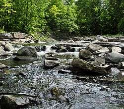 Little Etobicoke Creek north of The Queensway in Mississauga | |
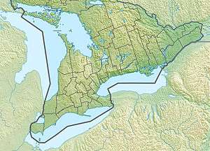 Location of the mouth of Little Etobicoke Creek in southern Ontario | |
| Location | |
| Country | Canada |
| Province | Ontario |
| Region | Greater Toronto Area |
| Regional Municipality | Peel |
| Municipality | Mississauga |
| Physical characteristics | |
| Source | |
| • coordinates | 43°38′50″N 79°39′23″W |
| • elevation | 169 m (554 ft) |
| Mouth | Etobicoke Creek |
• coordinates | 43°36′37″N 79°34′02″W |
• elevation | 106 m (348 ft) |
| Length | 10 km (6.2 mi) |
| Basin features | |
| River system | Great Lakes Basin |
Course
Little Etobicoke Creek emerges from a culvert on the south side of Britannia Road East, just east of Tomken Road. It flows southeast, passing under Highway 401, Eglinton Avenue, Eastgate Parkway, Burnhamthorpe Road and Bloor Street, before briefly heading northeast under Dixie Road. It then returns to a southeast path, passing under Dundas Street and the GO Transit Milton line, and finally turns east to its mouth at Etobicoke Creek just north of the Queensway (Peel Regional Road 20).
gollark: Yes.
gollark: Presumably, the cool™ ones.
gollark: We already have server with an aura of exclusive mystery, but that might not be the same.
gollark: No idea. I could add baidicoot and such, but they're inconsistently on.
gollark: It is not whatsoever or in any way pizza.
See also
References
- "Little Etobicoke Creek". Geographical Names Data Base. Natural Resources Canada. Retrieved 2012-08-02.
- "Topographic Map sheet 30M12". Atlas of Canada. Natural Resources Canada. 2006-02-06. Archived from the original on 2009-01-22. Retrieved 2009-02-14.
This article is issued from Wikipedia. The text is licensed under Creative Commons - Attribution - Sharealike. Additional terms may apply for the media files.