List of trails of Granite County, Montana
There are at least 52 named trails in Granite County, Montana according to the U.S. Geological Survey, Board of Geographic Names. A trail is defined as: "Route for passage from one point to another; does not include roads or highways (jeep trail, path, ski trail)."[1]
- Atlantic Cable Ski Trail, 46°15′23″N 113°14′31″W, el. 7,116 feet (2,169 m) [2]
- Bad Finger Ski Trail, 46°15′23″N 113°14′31″W, el. 7,116 feet (2,169 m) [3]
- Berkely Ski Trail, 46°15′23″N 113°14′31″W, el. 7,116 feet (2,169 m) [4]
- Black Pine Ridge Trail Number 6, 46°27′19″N 113°27′06″W, el. 7,447 feet (2,270 m) [5]
- Black Pine Trail, 46°30′45″N 113°27′27″W, el. 7,621 feet (2,323 m) [6]
- Boulder Lakes Trail, 46°21′19″N 113°07′04″W, el. 7,113 feet (2,168 m) [7]
- Butte Cabin Ridge Trail, 46°29′32″N 113°40′21″W, el. 7,933 feet (2,418 m) [8]
- Butte Cabin Ridge Trail, 46°31′18″N 113°40′44″W, el. 7,844 feet (2,391 m) [9]
- Catcha Wave Ski Trail, 46°15′23″N 113°14′31″W, el. 7,116 feet (2,169 m) [10]
- Christmas Park Ski Trail, 46°15′23″N 113°14′31″W, el. 7,116 feet (2,169 m) [11]
- Claimjumper Ski Trail, 46°15′23″N 113°14′31″W, el. 7,116 feet (2,169 m) [12]
- Combination Trail Number 3, 46°26′54″N 113°25′23″W, el. 6,896 feet (2,102 m) [13]
- Eightmile Harvey Ridge Trail, 46°36′01″N 113°29′11″W, el. 6,309 feet (1,923 m) [14]
- Gold Bug Ski Trail, 46°15′23″N 113°14′31″W, el. 7,116 feet (2,169 m) [15]
- Gold Rush Ski Trail, 46°15′23″N 113°14′31″W, el. 7,116 feet (2,169 m) [16]
- Good Finger Ski Trail, 46°15′23″N 113°14′31″W, el. 7,116 feet (2,169 m) [17]
- Grizzly Creek Trail, 46°34′02″N 113°36′17″W, el. 4,951 feet (1,509 m) [18]
- Guns and Roses Ski Trail, 46°15′23″N 113°14′31″W, el. 7,116 feet (2,169 m) [19]
- Haunted Forest Ski Trail, 46°15′23″N 113°14′31″W, el. 7,116 feet (2,169 m) [20]
- Hi Line Trail, 45°57′15″N 113°30′55″W, el. 8,583 feet (2,616 m) [21]
- Hogback Ridge Trail, 46°27′56″N 113°39′12″W, el. 7,900 feet (2,400 m) [22]
- John Long Trail, 46°38′46″N 113°31′10″W, el. 6,453 feet (1,967 m) [23]
- Limelight Ski Trail, 46°15′23″N 113°14′31″W, el. 7,116 feet (2,169 m) [24]
- Little Finger Ski Trail, 46°15′23″N 113°14′31″W, el. 7,116 feet (2,169 m) [25]
- Lower Willow Creek Trail Number Four, 46°28′53″N 113°21′38″W, el. 6,447 feet (1,965 m) [26]
- Lums Run Ski Trail, 46°15′23″N 113°14′31″W, el. 7,116 feet (2,169 m) [27]
- Maloney Trail Number 5, 46°29′01″N 113°28′37″W, el. 6,690 feet (2,040 m) [28]
- Manhattan Ski Trail, 46°15′23″N 113°14′31″W, el. 7,116 feet (2,169 m) [29]
- Maverick Ski Trail, 46°15′23″N 113°14′31″W, el. 7,116 feet (2,169 m) [30]
- Medicine Ridge Ski Trail, 46°15′23″N 113°14′31″W, el. 7,116 feet (2,169 m) [31]
- Mills Road Ski Trail, 46°15′23″N 113°14′31″W, el. 7,116 feet (2,169 m) [32]
- Mother Lode Ski Trail, 46°15′23″N 113°14′31″W, el. 7,116 feet (2,169 m) [33]
- Northern Lights Ski Trail, 46°15′23″N 113°14′31″W, el. 7,116 feet (2,169 m) [34]
- Old Number Seven Ski Trail, 46°15′23″N 113°14′31″W, el. 7,116 feet (2,169 m) [35]
- Otters Hump Trail, 46°34′02″N 113°36′17″W, el. 4,951 feet (1,509 m) [36]
- Platinum Ski Trail, 46°15′23″N 113°14′31″W, el. 7,116 feet (2,169 m) [37]
- Pole Ridge Trail, 46°32′54″N 113°29′09″W, el. 7,109 feet (2,167 m) [38]
- Quigg Peak Trail, 46°28′57″N 113°41′14″W, el. 8,022 feet (2,445 m) [39]
- Ranch Creek Trail, 46°28′27″N 113°36′10″W, el. 6,358 feet (1,938 m) [40]
- Red Lion Ski Trail, 46°15′23″N 113°14′31″W, el. 7,116 feet (2,169 m) [41]
- Sandstone Ridge Trail, 46°27′02″N 113°34′22″W, el. 7,657 feet (2,334 m) [42]
- Sapphire Ski Trail, 46°15′23″N 113°14′32″W, el. 7,129 feet (2,173 m) [43]
- Silver Bow Ski Trail, 46°15′23″N 113°14′31″W, el. 7,116 feet (2,169 m) [44]
- Sluice Box Ski Trail, 46°15′23″N 113°14′31″W, el. 7,116 feet (2,169 m) [45]
- Snaggle Tooth Ski Trail, 46°15′23″N 113°14′31″W, el. 7,116 feet (2,169 m) [46]
- Solomon Ridge Trail, 46°39′17″N 113°42′24″W, el. 6,516 feet (1,986 m) [47]
- Southern Cross Ski Trail, 46°15′23″N 113°14′31″W, el. 7,116 feet (2,169 m) [48]
- Spooky Hollow Ski Trail, 46°15′23″N 113°14′31″W, el. 7,116 feet (2,169 m) [49]
- Tenderfoot Ski Trail, 46°15′23″N 113°14′31″W, el. 7,116 feet (2,169 m) [50]
- Terminator Ski Trail, 46°15′23″N 113°14′31″W, el. 7,116 feet (2,169 m) [51]
- The Pitch Ski Trail, 46°15′23″N 113°14′31″W, el. 7,116 feet (2,169 m) [52]
- Willow Harvey Divide Trail, 46°34′09″N 113°31′21″W, el. 7,365 feet (2,245 m) [53]
Further reading
- Arthur, Jean (2000). Winter Trails Montana: The Best Cross-Country Ski & Snowshoe Trails. Guilford, CT: Globe Pequot. ISBN 0-7627-0730-5.
- Spring, Ira (1974). Wilderness trails Northwest;: A hiker's and climber's overview-guide to national parks and wilderness areas in Wyoming, Montana, Idaho, Northern California, . British Columbia, Canadian Rockies. Touchstone Press. ISBN 0-911518-25-8.
- Willard, John A. (1986). Adventure Trails in Montana. Pruett Publishing Co. ISBN 0-87108-726-X.
- Howard, Lynna and Leland (2000). Along Montana & Idaho's Continental Divide Trail. Westcliff Publishers. ISBN 1-56579-343-9.
- Wolf, John R. (1992). Guide to the Continental Divide Trail: Northern Montana. Continental Divide Trail Society. ISBN 0-934326-01-0.
- Barnett, Carellen (1997). Trail Riding Western Montana. Guilford, CT: Falcon Press Publishing. ISBN 1-56044-336-7.
- Schneider, Bill (1995). Hiking Montana. Guilford, CT: Falcon Press Publishing. ISBN 1-56044-381-2.
gollark: Or templates?
gollark: Control flow is based on... links between pages somehow.
gollark: Idea: mediawiki... esolang?
gollark: This page is protected against creationThis page has been protected against creation and cannot be created without administrator help; by far the most common reason for this to happen is that it has been repeatedly created by spambots and has been protected to prevent those spambots attacking it in the future. If you do need to create a page at this title, place a request for the page to be unprotected (for instance at the Talk page of the administrator who protected it; check this page's history to find out who that was).
gollark: Do trees know how to use TeX™?
Notes
- "Geographic Names Information System (GNIS) Feature Class Definitions". U.S. Geological Survey. Retrieved 2011-07-26.
- "Atlantic Cable Ski Trail". Geographic Names Information System. United States Geological Survey.
- "Bad Finger Ski Trail". Geographic Names Information System. United States Geological Survey.
- "Berkely Ski Trail". Geographic Names Information System. United States Geological Survey.
- "Black Pine Ridge Trail Number 6". Geographic Names Information System. United States Geological Survey.
- "Black Pine Trail". Geographic Names Information System. United States Geological Survey.
- "Boulder Lakes Trail". Geographic Names Information System. United States Geological Survey.
- "Butte Cabin Ridge Trail". Geographic Names Information System. United States Geological Survey.
- "Butte Cabin Ridge Trail". Geographic Names Information System. United States Geological Survey.
- "Catcha Wave Ski Trail". Geographic Names Information System. United States Geological Survey.
- "Christmas Park Ski Trail". Geographic Names Information System. United States Geological Survey.
- "Claimjumper Ski Trail". Geographic Names Information System. United States Geological Survey.
- "Combination Trail Number 3". Geographic Names Information System. United States Geological Survey.
- "Eightmile Harvey Ridge Trail". Geographic Names Information System. United States Geological Survey.
- "Gold Bug Ski Trail". Geographic Names Information System. United States Geological Survey.
- "Gold Rush Ski Trail". Geographic Names Information System. United States Geological Survey.
- "Good Finger Ski Trail". Geographic Names Information System. United States Geological Survey.
- "Grizzly Creek Trail". Geographic Names Information System. United States Geological Survey.
- "Guns and Roses Ski Trail". Geographic Names Information System. United States Geological Survey.
- "Haunted Forest Ski Trail". Geographic Names Information System. United States Geological Survey.
- "Hi Line Trail". Geographic Names Information System. United States Geological Survey.
- "Hogback Ridge Trail". Geographic Names Information System. United States Geological Survey.
- "John Long Trail". Geographic Names Information System. United States Geological Survey.
- "Limelight Ski Trail". Geographic Names Information System. United States Geological Survey.
- "Little Finger Ski Trail". Geographic Names Information System. United States Geological Survey.
- "Lower Willow Creek Trail Number Four". Geographic Names Information System. United States Geological Survey.
- "Lums Run Ski Trail". Geographic Names Information System. United States Geological Survey.
- "Maloney Trail Number 5". Geographic Names Information System. United States Geological Survey.
- "Manhattan Ski Trail". Geographic Names Information System. United States Geological Survey.
- "Maverick Ski Trail". Geographic Names Information System. United States Geological Survey.
- "Medicine Ridge Ski Trail". Geographic Names Information System. United States Geological Survey.
- "Mills Road Ski Trail". Geographic Names Information System. United States Geological Survey.
- "Mother Lode Ski Trail". Geographic Names Information System. United States Geological Survey.
- "Northern Lights Ski Trail". Geographic Names Information System. United States Geological Survey.
- "Old Number Seven Ski Trail". Geographic Names Information System. United States Geological Survey.
- "Otters Hump Trail". Geographic Names Information System. United States Geological Survey.
- "Platinum Ski Trail". Geographic Names Information System. United States Geological Survey.
- "Pole Ridge Trail". Geographic Names Information System. United States Geological Survey.
- "Quigg Peak Trail". Geographic Names Information System. United States Geological Survey.
- "Ranch Creek Trail". Geographic Names Information System. United States Geological Survey.
- "Red Lion Ski Trail". Geographic Names Information System. United States Geological Survey.
- "Sandstone Ridge Trail". Geographic Names Information System. United States Geological Survey.
- "Sapphire Ski Trail". Geographic Names Information System. United States Geological Survey.
- "Silver Bow Ski Trail". Geographic Names Information System. United States Geological Survey.
- "Sluice Box Ski Trail". Geographic Names Information System. United States Geological Survey.
- "Snaggle Tooth Ski Trail". Geographic Names Information System. United States Geological Survey.
- "Solomon Ridge Trail". Geographic Names Information System. United States Geological Survey.
- "Southern Cross Ski Trail". Geographic Names Information System. United States Geological Survey.
- "Spooky Hollow Ski Trail". Geographic Names Information System. United States Geological Survey.
- "Tenderfoot Ski Trail". Geographic Names Information System. United States Geological Survey.
- "Terminator Ski Trail". Geographic Names Information System. United States Geological Survey.
- "The Pitch Ski Trail". Geographic Names Information System. United States Geological Survey.
- "Willow Harvey Divide Trail". Geographic Names Information System. United States Geological Survey.
Municipalities and communities of Granite County, Montana, United States | ||
|---|---|---|
| Towns | 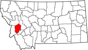 Granite County map | |
| CDP | ||
| Unincorporated community | ||
| Ghost towns | ||
This article is issued from Wikipedia. The text is licensed under Creative Commons - Attribution - Sharealike. Additional terms may apply for the media files.