List of neighborhoods in Newark, New Jersey
The following is a list of neighborhoods in Newark, New Jersey, United States within its five political wards.[1] each with distinct neighborhoods.[2]
North Ward
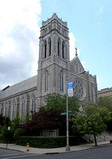
St. Rose of Lima Church in Roseville
- Broadway
- Forest Hill
- Mount Pleasant
- Roseville
- Seventh Avenue
- Woodside
South Ward
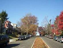
A residential street in Weequahic
- Clinton Hill
- Dayton
- Port Newark
- South Broad Valley
- Weequahic
Central Ward
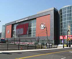
Prudential Center, Downtown Newark
- The Coast/Lincoln Park
- Downtown Newark
- Government Center
- Springfield/Belmont
- University Heights
- Teachers Village
iITB Blvd
East Ward
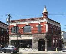
Former Engine 8 quarters of the NFD, located in the Ironbound
- Four Corners
- Five Corners
- Gateway Center
- The Ironbound
West Ward
gollark: Ban American date formatting.
gollark: Anyway, as I was saying, who except lemmmy would be interested in an automatic laser lawnmower?
gollark: Excellent, that version of potatOS will be stored forever.
gollark: So what stuff has this horribly broken?
gollark: I think it would have been possible to adapt to the new wood-based world with time.
References
- "Newark City Ward Boundaries (2000)" (PDF). Rutgers University. 2000. Archived from the original (PDF) on July 24, 2013. Retrieved February 25, 2012.
- "Newark Zoning and Land Use Regulations" (PDF). City of Newark. 29 August 2014. Archived from the original (PDF) on 2016-03-04. Retrieved 2 November 2015.
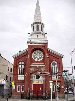
St. Stephen's Church, a Five Corners landmark
This article is issued from Wikipedia. The text is licensed under Creative Commons - Attribution - Sharealike. Additional terms may apply for the media files.